
‘I’d be getting my car under cover’: Chance of hailstones, storms, and damaging winds as cold fronts move in
One Australian state could be battered with hailstones, storms and damaging winds as a series of cold fronts move through.

Environment
Don't miss out on the headlines from Environment. Followed categories will be added to My News.
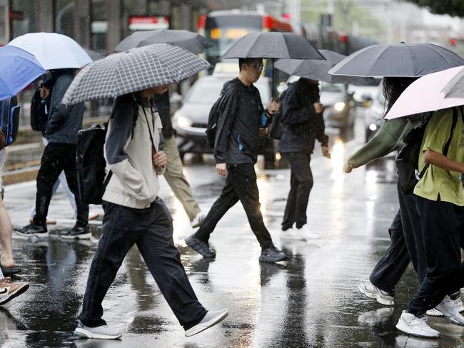
Australia’s southeast is expected to be battered by showers and storms heading into the weekend, with Victorians warned of potential hailstones and flash flooding.
Sky News Weather meteorologist Alison Osborne said there was a slim risk that hailstones “grape size or larger” could hit Central Victoria on Friday.
“Also the risk of some isolated heavy rainfall which can trigger flash flooding,” Ms Osborne said.
“While the risk is on the lower side, if I was in central Victoria and heard the rumble of thunder this afternoon, I’d be getting my car under cover.
“Across Victoria we are now watching for storms to develop this afternoon in the wake of a cooler westerly change which should push through those central districts during the afternoon.”
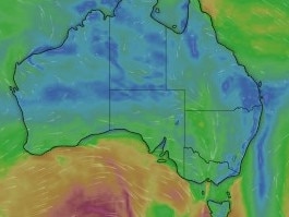
The Bureau of Meteorology has issued a severe weather warning for damaging winds across parts of Central, North Central, and West and South Gippsland districts that are expected to ease through Friday afternoon.
Ms Osborne said showers and thunderstorms were likely to extend through inland NSW, with the chance of late showers in Sydney on Friday.
Storms could also extend as far as outback Queensland on Friday.
“A series of cold fronts are lining up for southern Australia, one crossing today leading to showers and storms extending into outback Queensland,” Ms Osborne said.
“This will be followed by another system delivering showers through the southeast and then another on Sunday.”
A low pressure trough from Kimberley in Western Australia could head towards southern Queensland, bringing daily storm activity; however, Ms Osborne said there isn’t much rainfall anticipated.
“Heaviest falls are likely to be in showers and storms targeting central and eastern Victoria and into the NSW slopes and plains, upwards of 15mm,” she said.
“Severe thunderstorms are a risk today … There’s a risk of blustery thunderstorms with little rainfall over northwestern NSW and southwestern Queensland.”
Sydney is expected to experience showers across Friday and Saturday before conditions are tipped to clear on Sunday, with the city set to hit a high of 28C over the weekend.
Melbourne is tipped for showers and a top of 23C heading into the weekend, while Brisbane can expect to be mostly sunny with a high of 33C.
Perth is set for showers and a top of 23C, while Adelaide is forecast for similar conditions with a top of 21C heading into the weekend.
Showers are forecast across Hobart with a top of 20C heading into the weekend, with showers expected in Canberra with a high of 21C.
Darwin is set to hit 35C across the weekend with possible showers.


Originally published as ‘I’d be getting my car under cover’: Chance of hailstones, storms, and damaging winds as cold fronts move in
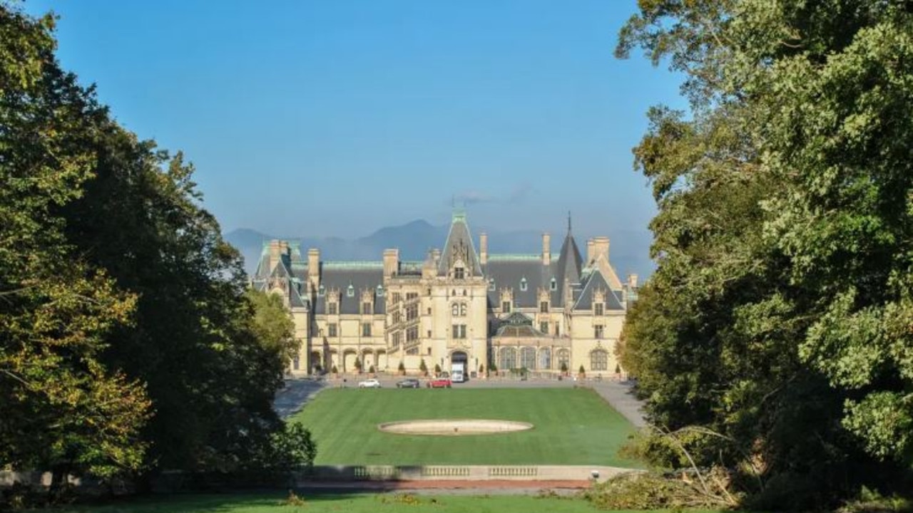
Hurricane destroys America’s largest home
America’s largest home was caught in the middle of Hurricane Helene. The sprawling estate’s owners have revealed just how bad the damage is.
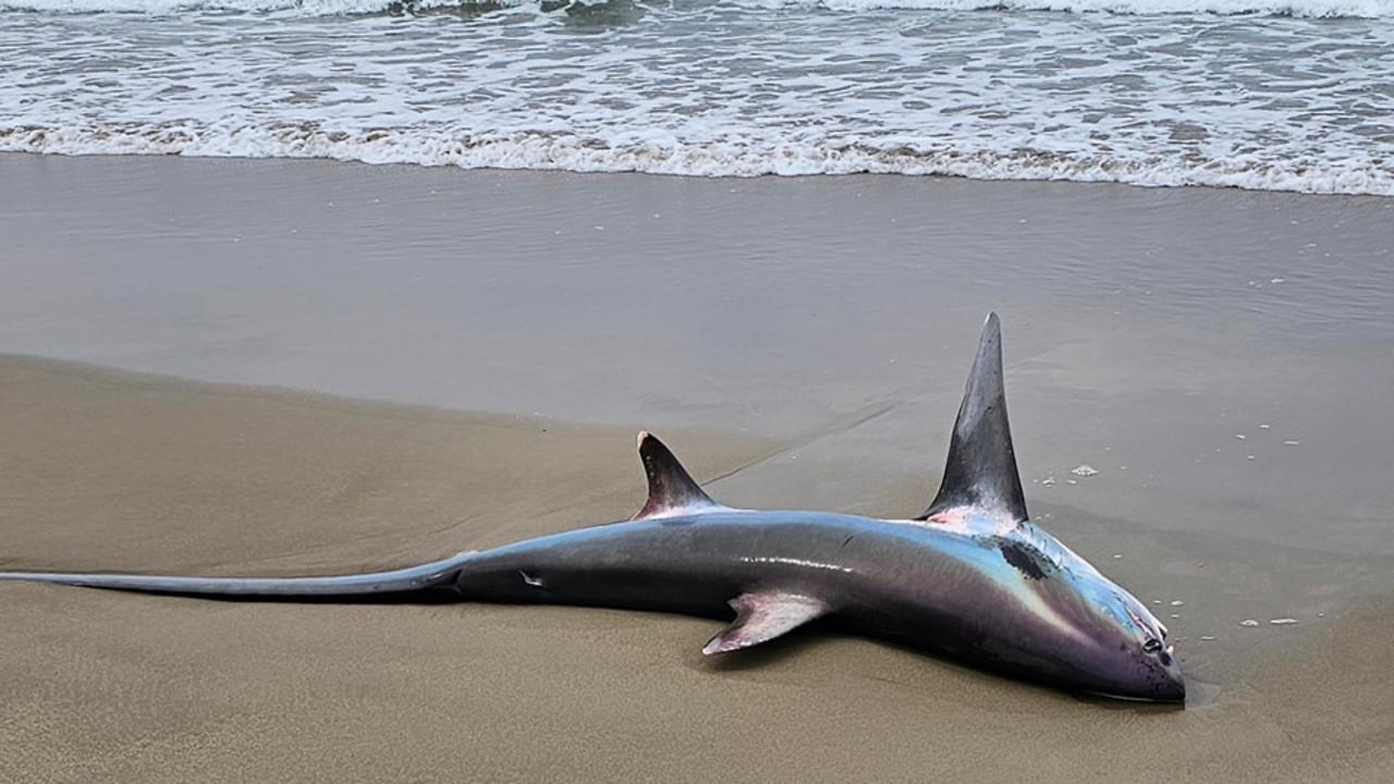
Shock discovery at popular Aussie beach
Beachgoers were shocked to discover a near mythical beast had washed ashore at a popular beach.