‘Dangerous’: rain to hit east coast as temperatures spike to 46C
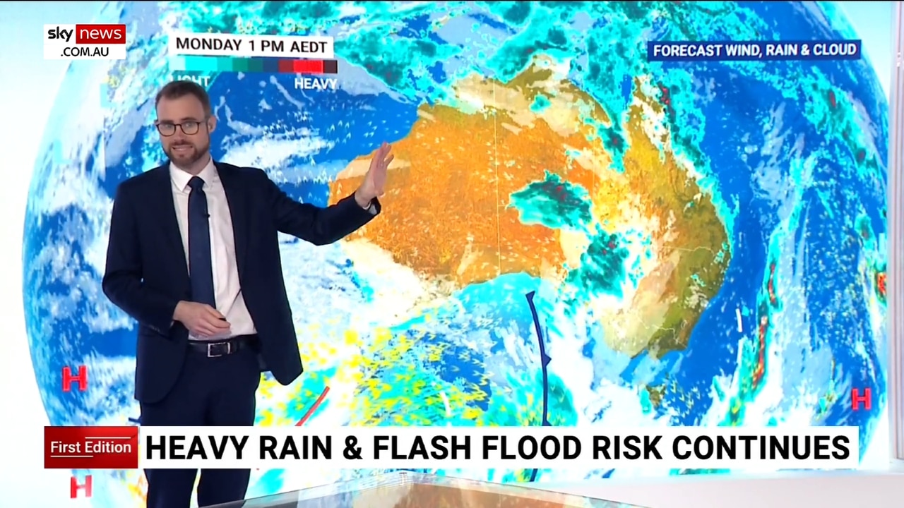
Millions of Australians have been warned to brace for potential flash flooding and severe thunderstorms as intense rain hits the east coast this week.
Environment
Don't miss out on the headlines from Environment. Followed categories will be added to My News.
Australians are set to swelter through another scorcher, with temperatures tipped to reach as high as 46C in some parts of the country, while the east coast braces itself for another barrage of severe thunderstorms and rain in the coming days.
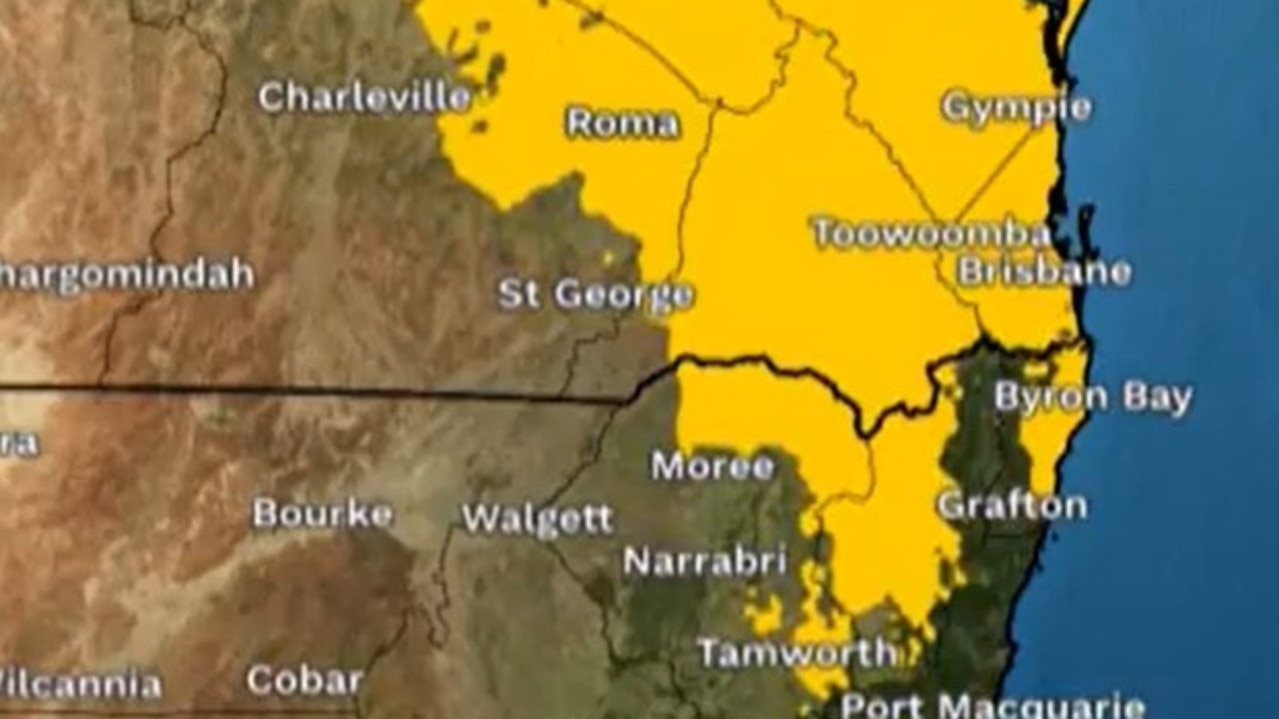
The Bureau of Meteorology has warned of a band of wet weather, damaging winds and severe thunderstorms passing through the southern Queensland, island NSW, ACT, central and eastern Victoria and most of Tasmania on Tuesday, warning there may be a chance of flash flooding.
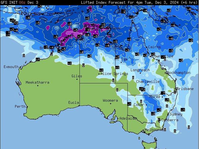
“With those storms, we could see flash flooding, particularly through southern Queensland and northern NSW, with those storms [brings] heavy rainfall rates, and that could also lead to dangerous driving conditions,” said BOM senior meteorologist Dean Narramore.
The impact of the storms could be catastrophic, with the risk of fallen power lines, flash flooding, damaging winds and falling trees.
“If you’re out and about through country parts of Victoria and northeast parts of NSW and southern Queensland, some of these storms, if you’re directly underneath them, could bring down trees and power lines, lead to localised power outages and also cause inundation for homes, properties and businesses.”
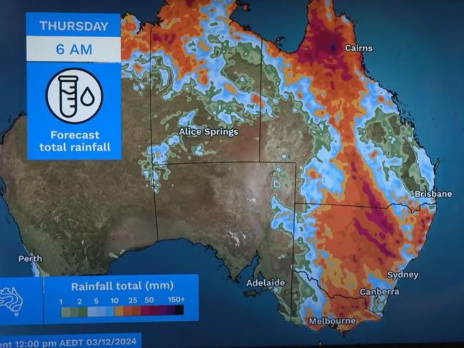
Heavy rainfall is expected to persist for three days, Mr Narramore warned, with widespread of up to 50mm of rainfall in northeast Victoria, much of inland NSW and southern and northern Queensland, where rainfall could reach 100mm.
“With all this rainfall on already saturated soils and catchments, it does mean we could see renewed floodrisk for northeast Victoria and southeast NSW,” said Mr Narramore.
On Sunday, heavy rain hit Brisbane, leaving many stranded as roads quickly turned into rivers.
In the span of an hour, the inner-south suburbs copped 88mm of rainfall, while Brisbane’s inner-west recorded 70mm and the CBD saw 51mm in 30 minutes.
HOT AND HUMID SUMMER INCOMING
The severe weather warning comes as Sky News Weather meteorologist Rob Sharpe said inland parts of Western Australia’s Pilbara region would be pushing the mid-40s over the next few days.
“Paraburdoo is forecast to reach as high as 46C, and their December record is 48C, so not too far off,” Mr Sharpe said.
Marble Bar is also in for a scorcher, with temperatures forecast to reach 45C on Wednesday and Thursday.
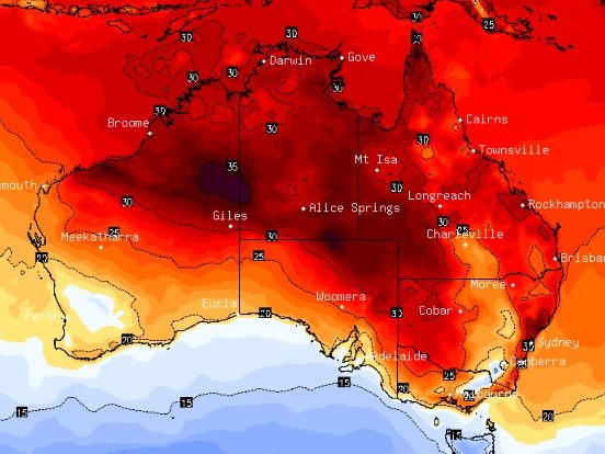
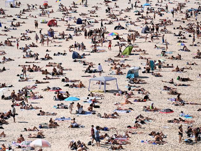
He said some pockets of Central Australia were set for extreme heatwave conditions over the next few days.
“But then some of that heat will flow into the south and east of the country,” Mr Sharpe said.
“Adelaide will see temperatures spike on Thursday at 37C and they’ll be on the edge of a low intensity heatwave.”
Melbourne and Sydney – in particular out west – are expected to hit temperatures in the 30s between Thursday and Sunday.
“A warm and humid run expected,” Mr Sharpe said.
However, Aussies can breath a sigh of relief with news the heat spell won’t be as intense as the last couple weeks.
“Yes, we’ve got another spell of heat, but it’s not as intense,” Mr Sharpe said.
He also said heat records were likely to remain uncontested for the next few weeks, with records more likely to be broken towards the end of December.
“We’ve seen some pretty significant wet weather … slowed the heating trend a bit for Australia with all this rain and storm activity,” Mr Sharpe said.
“It’s more about the rain and the storms this month.”
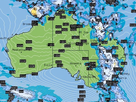
Severe thunderstorms are set to make their way to the eastern states by Tuesday, with stormy and humid conditions for most of northern Victoria, central and northern NSW, and southern Queensland.
The Bureau of Meteorology has warned residents of flash flooding across the southern slopes of NSW and eastern Riverina, which could be potentially life-threatening.
Extreme heatwaves will likely continue through the week, beginning through inland parts of the western Kimberley and Interior in Western Australia and western South Australia. By Wednesday, these extreme heat conditions are expected to shift.
HOTTEST SPRING ON RECORD
The warnings come after the bureau revealed the country recorded its hottest spring on record.
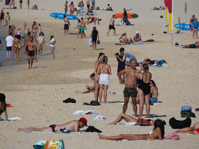
The eastern coast of Australia sweltered through a week-long heatwave, with the region preparing to brace for more in the first week of summer.
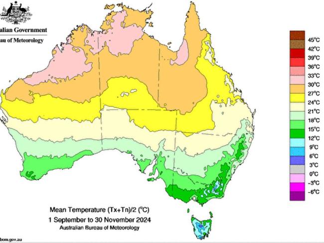
In the recently released season summary, the bureau reported its warmest spring on record, dating back to 1910.
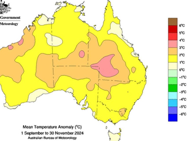
The national mean temperature for spring, which is recorded by evaluating the average of the 112 weather stations located across the country, was an estimated 2.08C higher than the baseline 1961-1990 average – a far hotter spring than normal and a sign of what’s to come for summer.
It was the hottest spring on record in Queensland for mean and minimum temperatures residents, which broke its previous record in 2020 by about 0.4C. The state’s maximum temperature was the second-highest on record.
It was a similar story for Western Australia, which also recorded its warmest spring mean temperature, while mean temperatures in South Australia were the second-highest on record.
In fact, no state recorded a colder-than-usual spring, with each area of the country recording their top 10 warmest seasons on record.
Not only was spring the hottest on record, it was also the wettest, with a mean national rainfall of 92mm, about 28 per cent above the 1961-1990 average.
Across the country, September and November were wetter than the seasonal average, though October was drier than average.
For most of WA and the Northern Territory, and parts of Queensland, NSW and SA, rainfall was very much above average for spring.
It was the fourth-wettest spring on record for WA, slightly more than double the 1961-1990 baseline average.
“Some stations, including several with more than 50 years of data, had their record highest total rainfall for spring,” a bureau spokesperson said.
“However, the same could not be said for parts of southwestern Western Australia, southeast South Australia, southeastern NSW and northeastern Queensland, where rainfall was below to very much below average for spring.”
Victoria also recorded its driest spring since 2019, with rainfall below average in large parts of the state.
Originally published as ‘Dangerous’: rain to hit east coast as temperatures spike to 46C


