NewsBite

Harrowing before and after photos of the LA wildfires

Massive wildfires that engulfed whole neighbourhoods and displaced thousands in LA remained totally uncontained. See the trail of destruction they left behind.

LA fires: Before and after scenes that'll shock you

Massive wildfires that engulfed whole neighbourhoods and displaced thousands in Los Angeles remained totally uncontained, as US National Guard soldiers readied to hit the streets to help stop looting and disorder.

Swaths of the United States’ second-largest city lay in ruins, with smoke blanketing the sky and an acrid smell pervading almost every building.

A vast firefighting operation continued for a third day, bolstered by water-dropping helicopters thanks to a temporary lull in winds.

Amid the chaos, looting had broken out, with numerous arrests made, officials said, and hundreds of soldiers were set to be deployed.

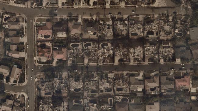
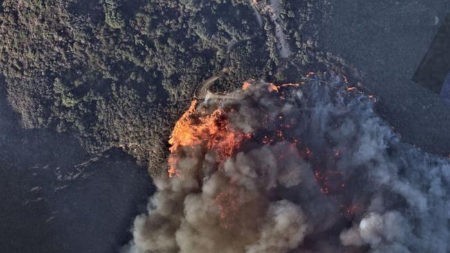
Aerial images have also emerged showing the shocking aftermath of the wildfires after they ripped through neighbourhoods.

See the before and after images below:

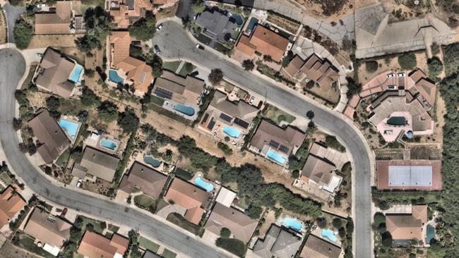
BEFORE
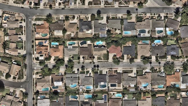
Aerial image of Valleylights Dr, Pasadena. Picture: Nearmap

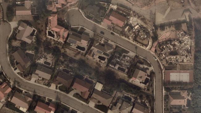
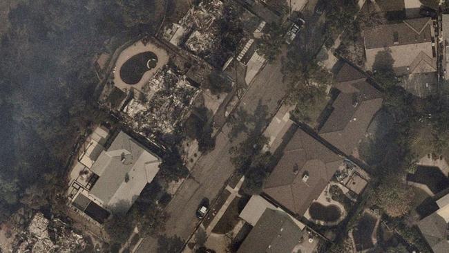
AFTER

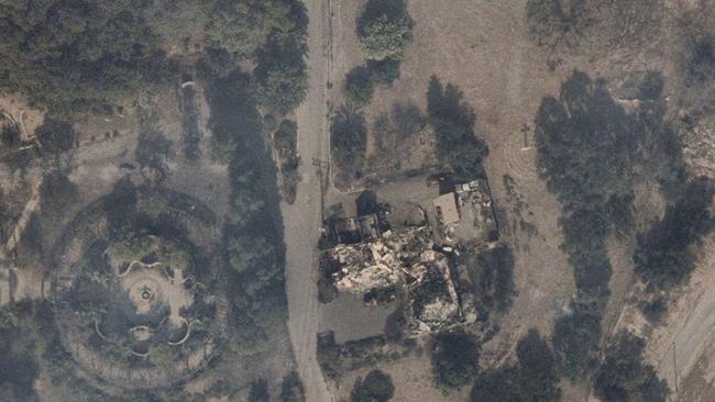
After the fire spread through Valleylights Dr, Pasadena. Picture: Nearmap

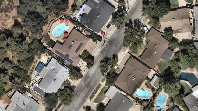
BEFORE

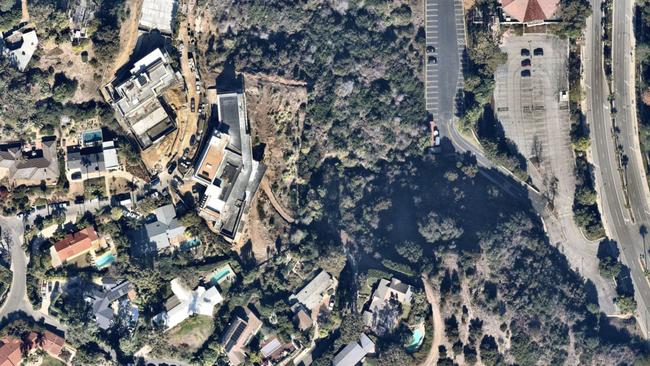
Aerial image of Park Vista Dr, Pasadena. Picture: Nearmap

AFTER

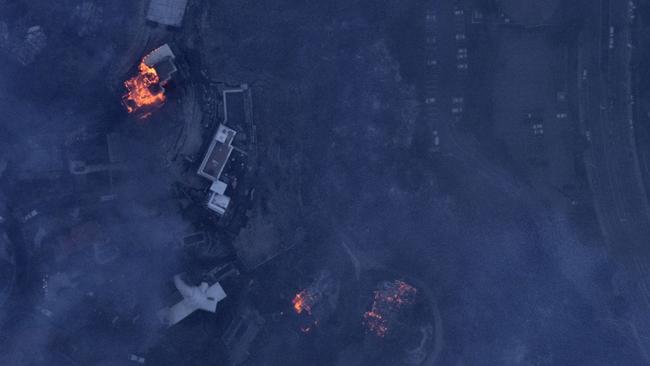
Aerial image of the devastating fire on Park Vista Dr, Pasadena. Picture: Nearmap

BEFORE

Aerial image of Riviera Dr, Pasadena. Picture: Nearmap

AFTER

Aerial image after the fire hit Riviera Dr, Pasadena. Picture: Nearmap

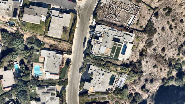
BEFORE

Aerial image of Lachman Ln, Pacific Palisades. Picture: Nearmap

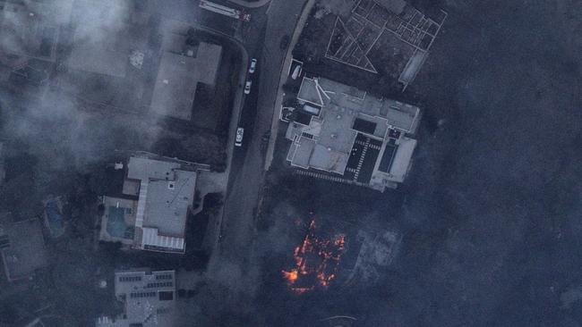
AFTER

Aerial image of Lachman Ln, Pacific Palisades burnt out. Picture: Nearmap

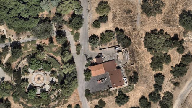
BEFORE

Aerial image of Sunnyside Ave Sierra Madre. Picture: Nearmap

AFTER

Aerial image of Sunnyside Ave Sierra after the fire hit. Picture: Nearmap

BEFORE

Aerial image of Catalonia Ave Pacific Palisades. Picture: Nearmap

AFTER

Aerial image of Catalonia Ave Pacific Palisades with smouldering fires still burning. Picture: Nearmap

BEFORE

Aerial image of California -118.567734 34° 3' 44_, -118° 34' 4_. Picture: Nearmap

AFTER

Aerial image of the devastating fire -118.567734 34° 3' 44_, -118° 34' 4_ . Picture: Nearmap

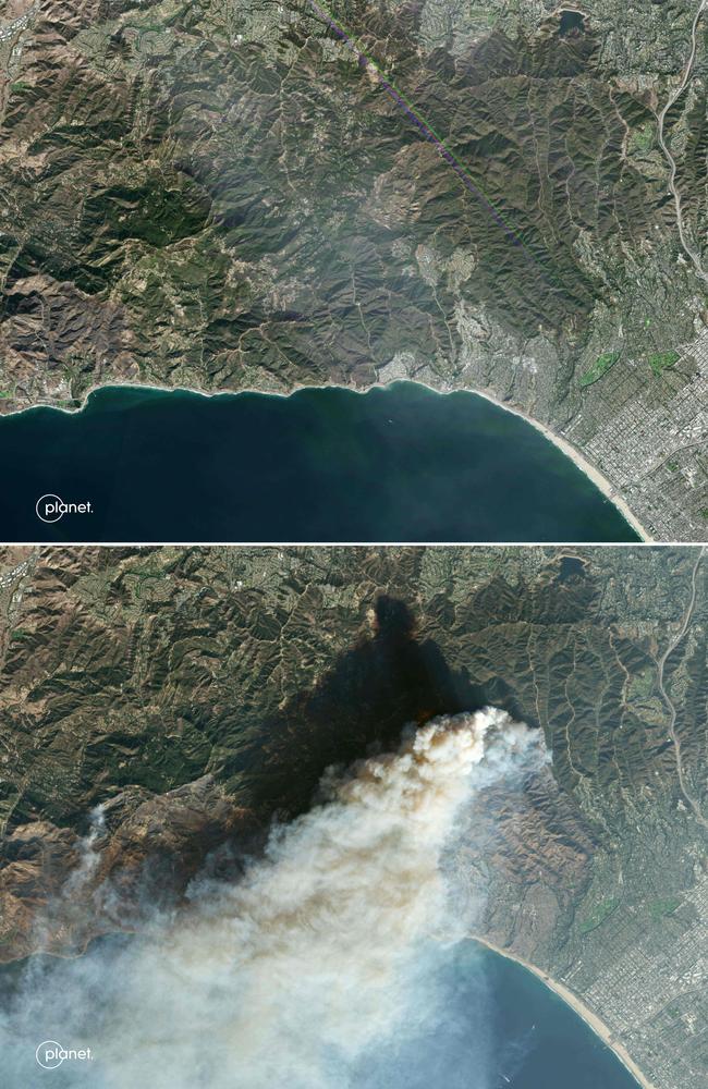
BEFORE AND AFTER

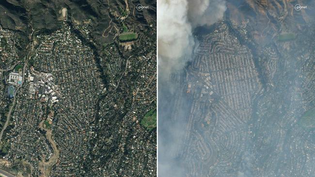
This combination of handout satellite images released by Planet Labs PBC shows an overview Pacific Palisades, a neighbourhood of Los Angeles, California prior to the impact of the Palisades Fire (top) on January 5, 2025 and during the fire (bottom). Picture: Planet Labs PBC / AFP

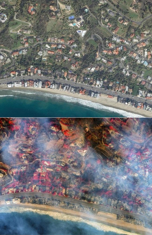
BEFORE AND AFTER

Homes before the Palisades fire in La Costa Beach, Malibu, Los Angeles, California on January 18, 2024, (bottom) this handout satellite picture courtesy of Maxar Technologies shows a Shortwave infrared (SWIR) overview of homes after in La Costa Beach, Malibu, Los Angeles, California on January 9, 2025. Picture: Maxar Technologies / AFP

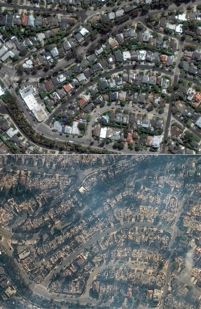
BEFORE AND AFTER

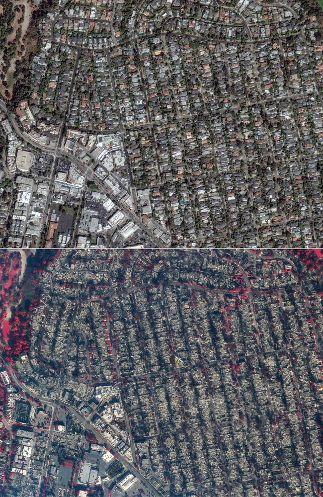
Satellite picture courtesy of Maxar Technologies shows homes in Pacific Palisades, a neighborhood of Los Angeles, California on October 20, 2024, before the Palisades fire., and (bottom) this handout satellite picture shows homes in Pacific Palisades, a neighborhood of Los Angeles, California on January 9. Picture: Maxar Technologies / AFP

BEFORE AND AFTER

Homes in Pacific Palisades, a neighbourhood of Los Angeles, California on October 20, 2024, before the Palisades fire, (bottom) this handout satellite shortwave infrared (SWIR) picture courtesy of Maxar Technologies shows homes in Pacific Palisades, a neighborhood of Los Angeles, California on January 9, 2025. Picture: Maxar Technologies / AFP

BEFORE AND AFTER

Satellite images released by Planet Labs PBC shows an overview Pacific Palisades, a neighbourhood of Los Angeles, California prior to the Palisades fire (L) on January 24, 2022 and during the fire on January 8, 2025. Picture: Planet Labs PBC / AFP

Originally published as Harrowing before and after photos of the LA wildfires

Add your comment to this story

To join the conversation, please Don't have an account? Register

Join the conversation, you are commenting as Logout

Original URL: https://www.adelaidenow.com.au/news/world/united-states/harrowing-before-and-after-photos-of-the-la-wildfires/news-story/75489f58c2913530e557c02c47fa813c