
Tasmania in the midst of a heatwave, with thunderstorms, heavy rain, wind gusts and hail forecast
Much of the state will reach the mid-30s over the coming days. But the Bureau of Meteorology has also warned ‘an abrupt change’ could bring more extreme weather and impact current bushfires.
Tasmania
Don't miss out on the headlines from Tasmania. Followed categories will be added to My News.
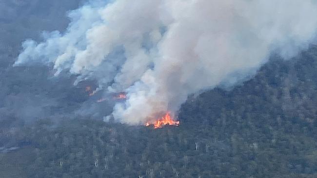
A bushfire at Snug is expected to keep burning “for some weeks yet” as the entire state grapples with a heatwave.
Hobart’s maximum temperature on Monday was 33 degrees, and Ouse recorded 37 – the highest in Tasmania.
Bureau of Meteorology Senior Meteorologist Alex Melitsis said the weather had been getting hotter over the previous few days and expected the heat to last until Tuesday.
“We’ll see temperatures get into the mid-30s across inland Tasmania today (Monday), and then again into the mid-30s again tomorrow,” Mr Melitsis said.
“As the heat continues, we are looking at a very warm night tonight across much of the state – particularly in the southern half of Tasmania where we could see minimum temperatures only dropping to the low to mid-20s overnight.”
However, on Tuesday, a cold front is expected to cross the state – which Mr Melitsis said would “bring an abrupt change and an end to the hot weather we’ve been seeing.
“We’re expecting the cold front to reach Hobart at midday tomorrow and then moving east, up towards Launceston and the northeast by tomorrow evening.
“And when that front crosses, that’ll bring an end to the hot spell, and we’ll see much more normal temperatures from Wednesday for the rest of the week.”
Mr Melitsis said people should expect thunderstorms on Monday and Tuesday.
“Today (Monday), we could see thunderstorms across the southern half of Tasmania, and they could be quite gusty, so we are monitoring for the potential of damaging gusts and severe thunderstorms this afternoon.
“And then tomorrow, as that cold front crosses, it’s going to be a very dramatic change – and we could see some thunderstorm activity on that cold front.
“So tomorrow, parts of inland, northern and eastern parts of Tasmania could see damaging wind gusts and thunderstorms – as well as perhaps heavy rain and even some hail.”
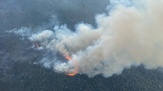
A bushfire has been aflame at Snug since January 28 and has so far burnt around 480 hectares.
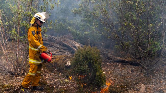
Tasmania Fire Service Southern Region Regional Chief Simon Pilkington said the blaze was contained.
“But we do encourage residents around the area to remain vigilant. It is in difficult to access terrain, so it will be continuing for some weeks yet,” Mr Pilkington said.
“The public in and around the Snug area will notice an increase in smoke.
“Most backburning operations are complete, but if they do see an increase, don’t panic as such because it may be linked to firefighting operations.”
Mr Pilkington also reminded the public that a fire permit suspension is still in place until 2am Wednesday.
More Coverage


Originally published as Tasmania in the midst of a heatwave, with thunderstorms, heavy rain, wind gusts and hail forecast

Successful hard waste collection service returns
Collecting over 40T of unwanted items annually, this successful hard waste scheme is returning to northern Tas for 2025. All for the small price of $10, residents can get rid of their bulky items.

Call for info into Tea Tree burglary after NSW car dumped
Police are seeking further information form the public after finding a NSW-registered car dumped following a burglary. The latest.