
Wildlife, stellar views and history abound in 10 of Adelaide’s best hikes
Wildlife, stellar views and walking on historic grounds — we explored some of the best trails around Adelaide for those eager to leave the crowds behind ahead of the 2019 hiking season.
SA News
Don't miss out on the headlines from SA News. Followed categories will be added to My News.
The Waterfall Gully to Mount Lofty hike has become a regular pilgrimage for fitness enthusiasts from across the city.
But ahead of the Hiking Expo at Belair National Park on Sunday, we explored some of the best trails in and around Adelaide, for those eager to leave the crowds behind.
WATERFALL HIKE
Difficulty: Medium
Length: 6.5km return
Route: Circuit from The Pines area in Belair National Park.
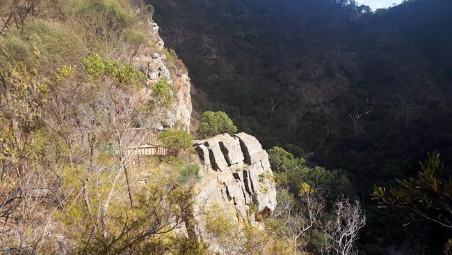
Winter-time hikers are treated to the rare sight of water cascading over Belair’s Upper Waterfall, forming a small rock pool beside the blackberry-chocked gully below.
Few places in the national park provide a more beautiful spot to take a break and catch your breath.
Here, Adelaide rosellas dart through the eucalypt trees and in the early evening, the retreating sun highlights the rock face’s beautiful red-brown colours.
Tall, spindly trees jut out of the gully. In death they still hold a special kind of beauty.
A little way down the track you’ll come across the much larger Lower Waterfall.
This is one of Belair’s more challenging walks but also a very peaceful one for the hiker keen to leave the stresses of city life behind for a couple of hours.
You’ll come across plenty of koalas and often see kangaroos and emus, too.
The kids will love exploring the long Echo Tunnel on the way back to the car — bring a torch for anyone a little nervous in the dark.
DEEP CREEK CIRCUIT HIKE
Difficulty: Hard
Length: 12km return
Route: Circuit from Trig Campsite or Tapanappa Lookout.
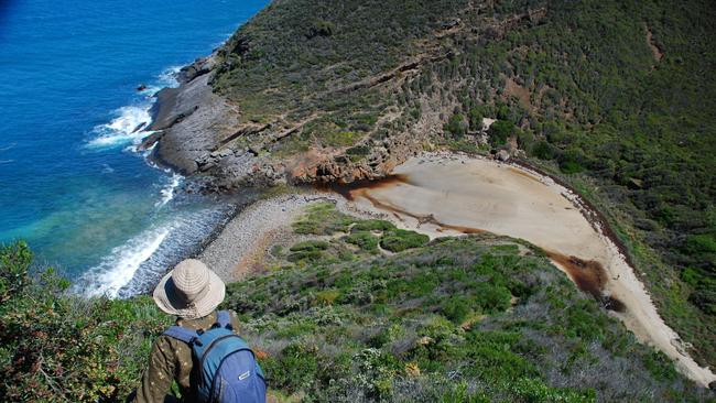
With beautiful natural scrubland, views out to the coast and secluded coves to explore, this hike should be on any keen walker’s list.
Taking up to seven hours, you can opt to camp in Deep Creek Conservation Park and tackle the journey over one long day or two shorter ones, pitching your tent at either Trig or Tapanappa campgrounds.
It’s one of the hardest hikes in Deep Creek, which is a nature-lover’s paradise with its combination of hills and coastal backdrops.
The climb up — and down — to Deep Creek Cove, is a challenging one but definitely worth the effort when you’re perched on the rocks below, looking out over the crashing waves.
Deep Creek is also the only Parks SA reserve near Adelaide with a campsite featuring hot showers — at the popular Stringybark campground — which may sound like a luxury but for some, is a necessity after a long day on your feet.
Book early to avoid disappointment because when the weather cools off, families scramble for the chance to toast their marshmallows around the fire pits once total fire bans are lifted in May.
You might be lucky enough to spot possums in the trees surrounding your tent at night.
And you’re almost certain to wake to the sounds of chortling magpies and see kangaroos feasting on grass around the campground early in the morning.
HALLETT COVE BOARDWALK
Difficulty: Medium
Length: 8km return
Route: Marino Rocks Cafe to Hallett Cove beach, return
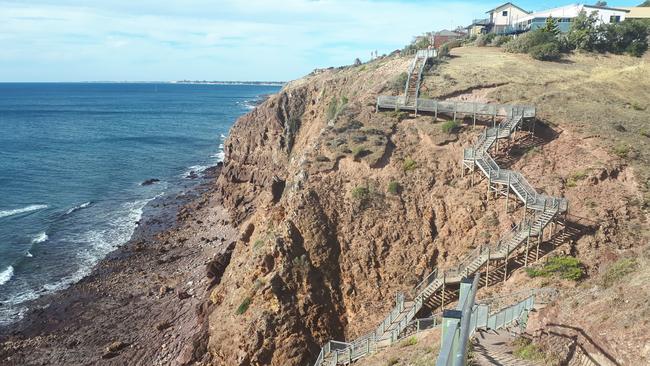
Hugging the tops of rugged cliffs at Marino and Hallett Cove, the Marion Coastal walk offers a birds-eye view of terrain that’s millions of years in the making.
Huge staircases descend into numerous gullies and when you come up the other side, you might wish heart-starting exercise like this was a more regular fixture on your calendar.
But the views of Gulf St Vincent’s deep blue sea, broken only by the occasional dolphin, kayaker or boatie are worth the effort as you climb one sky-reaching section after another.
Parks SA says the glacial pavements along the northern clifftops in Hallett Cove Conservation Park have international significance.
You can look down upon evidence of an Australian ice age about 280 million years ago.
Very popular with exercise-hungry 20-and-30-somethings, this is also a great place to go if you’re preparing for a longer hike with steep uphill sections — think Machu Picchu, Peru or Mount Kinabalu in Malaysian Borneo.
But with no trees to provide any shade, walkers are completely out in the elements, so be sure to take plenty of water.
Despite the cool breezes, it’s a trail best reserved for milder weather.
Stop off at either end for a drink or meal at Marino Rocks Cafe or the Boatshed, Hallett Cove.
MYRTACEAE WALK
Difficulty: Easy to Medium
Length: 6km
Route: Circuit from Kyeema Conservation Park trailhead on Woodgate Hill Rd
Kangaroos graze, black cockatoos call as they fly overhead and rosellas zip from tree to tree during a journey through the quiet Kyeema Conservation Park.
Next to the plantations at Kuitpo Forest, this area was devastated by the Ash Wednesday bushfires in 1983.
But local schoolchildren worked to regenerate the area, returning it to the safe haven for animals that is today, giving rise to an area known as The Children’s Forest.
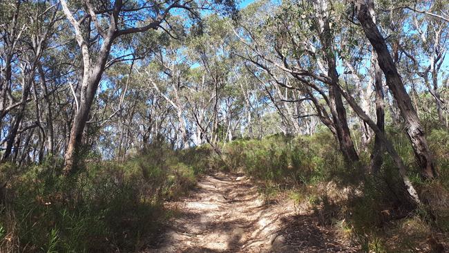
The first part of the journey follows a fire track, but the scenery becomes markedly more interesting as the trail narrows, offering a glimpse into life along the creek bed and high in the tree canopies.
Interpretative signage allows walkers to learn about the local flora and fauna.
A peaceful walk, the route has plenty of shade once the trail departs from the open fire track.
YURREBILLA TRAIL
Difficulty: Hard
Length: 54km
Route: One way trail from Belair Railway Station to Ambers Gully
Tackling this trail will see you trudging alongside creeks, sheer cliff faces and hobby farms and up some very steep hills.
The route takes between three and five days to complete, depending on how many kilometres you’re prepared to notch up in a day.
The trail, named after the adopted indigenous moniker for the Greater Mount Lofty Parklands, traverses some of greater Adelaide’s most impressive parks, including Belair, Cleland, Morialta, Horsnell Gully and Black Hill.
Encounters with echidnas, koalas, kangaroos and a range of beautiful birdlife are your reward for sticking it out along the 54km journey — that and the nuances of a bushland that gradually changes the further north you travel.
The hike includes part of Cleland’s popular Waterfall Gully to Mount Lofty walk and Three Falls Grand Hike in Morialta, but after these sections you’ll be able to sink back into your own little world and enjoy the calm sounds of the surrounding bushland.
At the end of a day’s climb, you can also stop by the Scenic Hotel at Norton Summit and relax with a drink on its slightly slopey balcony, which overlooks the bush and city.
ALDGATE VALLEY NATURE WALK
Difficulty: Easy to Medium
Length: 7km
Route: One-way between Aldgate’s main street and the Mylor Parklands
The little bandicoot markers directing walkers along this journey can at times be almost as tough to spot as the real nocturnal marsupials.
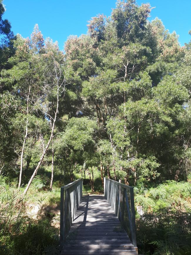
The walk follows the ‘Valley of the Bandicoots’ through a picturesque part of the Adelaide Hills, showcasing the work of community groups keen to conserve habitat.
The path meanders alongside roadsides, through charming conservation areas and up small inclines — a beautiful trail for families or those wanting a pleasant afternoon’s walk that won’t leave you too out of breath.
It’s a good idea to head out with at least one walking buddy on this trip, leaving a car at either end.
Alternatively, you can walk back from whence you came, but bus services in the area are scant on weekends and a taxi between Mylor and Aldgate will set you back about $20.
LADY PEARCE CIRCUIT HIKE + SOUTH PARA GRAND HIKE
Difficulty: Hard
Length: 14km
Route: Two loops beginning from Bowden’s Cottage, Allendale Rd
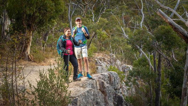
This walk has it all — oodles of wildlife, rich history, challenging inclines and views over Para Wirra Conservation Park that make the hard work worthwhile.
On a beautifully mild day, the park is surprisingly quiet — the busiest place on the journey being the lake at the reserve’s heart.
Beginning at Bowden’s Cottage, walkers learn about the former mine workings of Victoria Hill in the Barossa Goldfields, where miners flocked in the 1860s.
They’re also given a glimpse of the tough life faced by those during the Great Depression. Many families returned to the mine site during those years in an attempt to find whatever was left over the first time around.
The harder work starts upon entry to the South Para Grand Hike, but views from Devil’s Nose are a worthy reward.
With its rock formations, grass trees and plentiful wildlife, the park is a reminder of the beautiful landscapes on offer in Ikara-Flinders Ranges National Park.
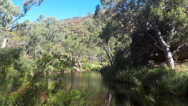
GORGE HIKE
Difficulty: Hard
Length: 6km
Route: Circuit route from Gate 11, Piggott Range Rd, in Onkaparinga Conservation Park
With lizards darting past and the sounds of cicadas clicking in the bush, the banks of Onkaparinga Gorge and its towering cliff faces offer hikers that contented feeling of being far away from town.
The beautiful gorge scenery stretches about 1.6km along this trail and with no other hikers around, it’s a great way to explore a beautiful part of our own backyard.
But it’s not a good idea to attempt this walk by yourself.
The trail makers disappear entirely along the length of the gorge section, leaving hikers to carefully select the safest route through thick vegetation and over rocks — sometimes, on their hands and knees over sloped rock faces right alongside the water.
There are also small sections where the trail — little more than an underdeveloped roo path — is so overgrown you can’t see what you’re about to tread on.
It’s not the nicest feeling during the warmer months, especially when there is no phone reception.
The longer, 21km Onkaparinga Gorge trek, can be tackled over two days.
THREE FALLS GRAND HIKE
Difficulty: Medium
Length: 7.3km
Route: Circuit hike from main Morialta trailhead
Morialta’s trails attract thousands of keen walkers from afar, and with good reason.
The park’s towering hills are a great training ground for anyone wanting to razzle up their endorphins and enjoy amazing scenery at the same time.

Three Falls Grand Hike is not quite as difficult as Mount Lofty but offers hikers amazing views of the grand scale of its towering cliffs and gullies.
From various vantage points all over the park, you can watch miniature hikers slowly make their way up the inclines.
Look out for Giant’s Cave down below.
But don’t forget to also look up every once in a while, otherwise you could easily miss the koalas watching you from their perches in the eucalypts.
YELLOWTAIL LOOP
Difficulty: Medium
Length: 7.5km
Route: Circuit from various locations in Anstey Hill Recreation Park
A popular trail for northeastern dwellers, Anstey Hill has something for everyone — animal lovers eager to spot koalas and kangaroos, birders on the lookout for tawny frogmouths and Australian golden whistlers and fitness lovers bracing for the park’s ‘Torture Hill Track’.
It’s even got some unique history thrown in, home to the substantial ruins of 1854-built Newman’s Nursery.
The property was unfortunate enough face a triple whammy of storms, floods and bushfires.
It was considered a showpiece in the SA colony and attracted visitors from across the country.
The surrounding gully contains evidence of the trees found at the nursery, providing a contrast to the otherwise native bushland.
The diverse Yellowtail Loop trail is the park’s longest, taking you past the nursery ruins and gullies, ridges, a creek and quarry site.
It’s a great walk if you want to experience a wide variety of native wildlife and get a solid couple of hours’ exercise.
Battle to save animals on the brink at Outback reserve
Conservationists are battling to save animals at an Outback reserve from the effects of the worst drought in recent memory, and have received a funding boost to redouble their efforts.

Country tradie to face court over incomplete work
A country tradesman will face the Elizabeth Magistrates Court over allegations he was not licenced and refused to refund money to clients.