Wild weather continues to lash SA with warnings of ice, snow, flash flooding
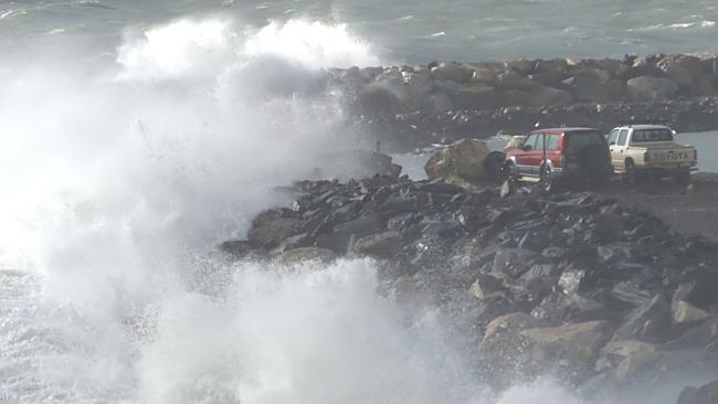
SNOW, ice, heavy rainfall and possible flooding has volunteers bracing for a hectic several days as the state prepares for more extreme winter weather.

SA News
Don't miss out on the headlines from SA News. Followed categories will be added to My News.
- Tragedy as man killed by falling tree while clearing storm debris
- Power out, trees down as wind lashes the state
- Gallery: SA’s wild, wild weather
VOLUNTEERS are bracing for a hectic several days as the state prepares for more extreme winter weather.
Flood warnings have been issued for regions including the Adelaide Hills, which were bombarded by gale-force winds on Monday.
Snow is expected to fall in the Adelaide Hills but residents are being warned to avoid the area because of treacherous driving conditions.
The Bureau of Meteorology has forecast about 80mm of rain to fall in the Adelaide Hills Tuesday tonight and into Wednesday morning, while the Mid North could expect about 30mm.
The Bureau has warned of a flood risk for the Mid North and Mt Lofty Ranges on Monday night and into Tuesday, particularly the Upper Onkaparinga, Upper Torrens and North Para River catchments.
Bureau of Meteorology regional director John Nairn said the state was in for a week of fluctuating weather, including likely snow in the Adelaide Hills on Wednesday.
“We are forecasting 11 degrees, but we have some concerns whether we can make 11 degrees (as the maximum),” Mr Nairn said.


“It will be very cold and we do anticipate seeing snow on the ranges, so probably from midmorning to midafternoon will be the optimal time to see snow.
“Of course it will be tempting for people to go into the Hills but we do know we have those hazardous conditions in terms of tree fall, so I think the best place to see the snow is from about here (the city).”
Mr Nairn said the worst conditions would happen while most people were sleeping.
“The heaviest rain we would be anticipating would be during the evening and early morning and would be easing by sunrise.
He said the windy weather would be replaced by very still and cold conditions Wednesday and Thursday.
“We will see very cold mornings, so we will see widespread frost across the interior of South Australia, particularly moving on into Thursday morning and it will be a larger frost that will start very early in the morning,” he said.
SES chief officer Chris Beattie said volunteers had responded to more than 550 call-outs since Sunday morning, while the CFS had attended more than 280 incidents — most of which involved falling trees.
Mr Beattie said that while winds would ease slightly, heavy rain anticipated overnight would pose a serious flooding threat.
“We’ve also been encouraging the community to help themselves and have been distributing sandbags at Lonsdale, Strathalbyn and Largs Bay in preparation for the forecast weather,” Mr Beattie said.
“We encourage people not to drive through floodwaters, and particularly for young people to stay away from creek beds, and don’t ride walk or play in floodwaters.”
He said rain would make driving in the Adelaide Hills treacherous.
“With very cold conditions forecast over the next couple of days we do have concerns for icy and slippery conditions in the hills,” he said.
Mr Beattie said there would be high tides along the coast but did not believe they presented the same risks as damaging king tides in May.
At the peak of the outage, 13,000 properties were without power and at 7.30pm on Monday night, 10,000 were still waiting for services to be restored.
SeaLink service from Cape Jervis resumed operation on 6pm but cancelled its services at both Kangaroo Island and Cape Jervis for the rest of the night due to strong winds.
The operator would reassessed the conditions before setting sail on Tuesday morning as extreme winds were forecasted.


