
Wild winds, storms across Greater Adelaide area bring flooding, power outages
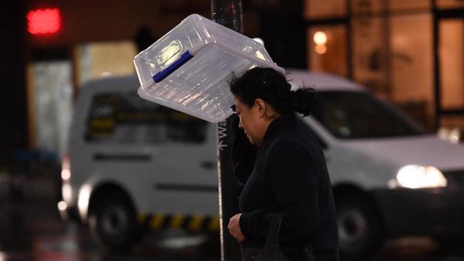
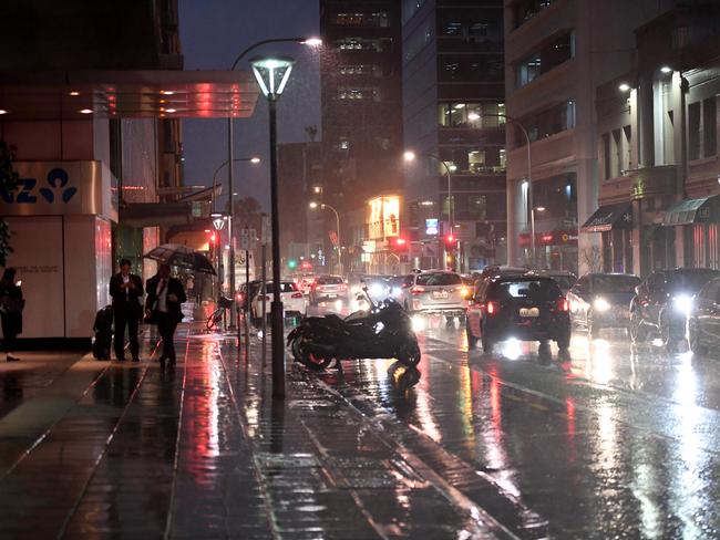
A STORM shattered windows, downed trees and caused flash flooding across the state on Thursday, with the Adelaide Hills hardest hit.

SA News
Don't miss out on the headlines from SA News. Followed categories will be added to My News.
A STORM shattered windows, downed trees and caused flash flooding across the state on Thursday, with the Adelaide Hills hardest hit.
SES responded to at least 100 calls for help as wind gusts brought down trees in the Mt Lofty Ranges district.
The Bureau of Meterology cancelled the last weather warnings for SA late on Thursday night.
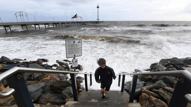
Around Adelaide, the wild weather whipped up powerful tidal surges along the coastline and caused flooding at Morphett Vale, Aberfoyle Park, Bedford Park and Aldgate.
The rough seas forced the closure of jetties at Largs, Brighton, Grange, Semaphore and Henley Beach. Wind gusting to almost 80km/h buffetted Adelaide, with gusts of 74km/h recorded at Adelaide Airport.
Staff at a fitness centre in Old Noarlunga reported rising water flooding in through the property’s back door.
In Netley, the force of the storm shattered a large window in one house and knocked tiles loose from the roof of another property. And the Moscow Circus performance in Bonython Park had to be cancelled.
By 10.30pm, the Country Fire Service had responded to more than 125 incidents including fallen trees and flooding.
The State Emergency Service was called out to provide sandbags as water rose towards properties across the metropolitan area.
.@SA_SES volunteers have responded approximately 80 requests for assistance in the past 24 hrs. The majority of the incidents have involved storm damage & trees down, most incidents have been around the #Adelaide metropolitan area & the #MountLoftyRanges pic.twitter.com/YBjMOEUsTT
— SA SES (@SA_SES) June 14, 2018
High winds and heavy rain were pushed ahead of a cold front which stretched for hundreds of kilometres across the lower half of the state.
The front will bring a chilly weekend, with Adelaide not expected to get above 15C until the middle of next week.
Friday’s forecast is for up to 6mm on rainfall with 25- 35km/h winds.
Mount Gambier was battered by 90km/h wind gusts throughout the afternoon, blacking out almost 1800 properties on the western side of the town. Another 100 properties were without power in Millicent, Tantanoola and Canunda.
More than 15mm of rain fell on Naracoorte and Mount Gambier over a short period in the afternoon.
Imagery from the SES shows the extent of rain across the Greater Adelaide area from 5pm to 6pm.
"MARGE, the rains are here!"
— SA SES (@SA_SES) 14 June 2018
Check out the rainfall recorded across the Greater Adelaide area within the last hour.
For SES response in floods or storms telephone 132 500. If the matter is life threatening telephone 000. pic.twitter.com/sWPiHXt0uL
Neptune Island in the Spencer Gulf endured gusts of 96km/h as the storm front passed over the remote island.
The cold front is one of several formed in the Great Australian Bight to batter South Australia before heading toward the eastern states.
The cold front will drop temperatures to a maximum of just 14C on Saturday and Sunday in the Adelaide metro area.
Quick, heavy rainfall can cause flash flooding and turn visible obstacles invisible. Take care this afternoon #SouthAustralia and never drive, ride or walk through floodwater. pic.twitter.com/q0yjkTo1ae
— SA SES (@SA_SES) 14 June 2018
Battle to save animals on the brink at Outback reserve
Conservationists are battling to save animals at an Outback reserve from the effects of the worst drought in recent memory, and have received a funding boost to redouble their efforts.

Country tradie to face court over incomplete work
A country tradesman will face the Elizabeth Magistrates Court over allegations he was not licenced and refused to refund money to clients.