
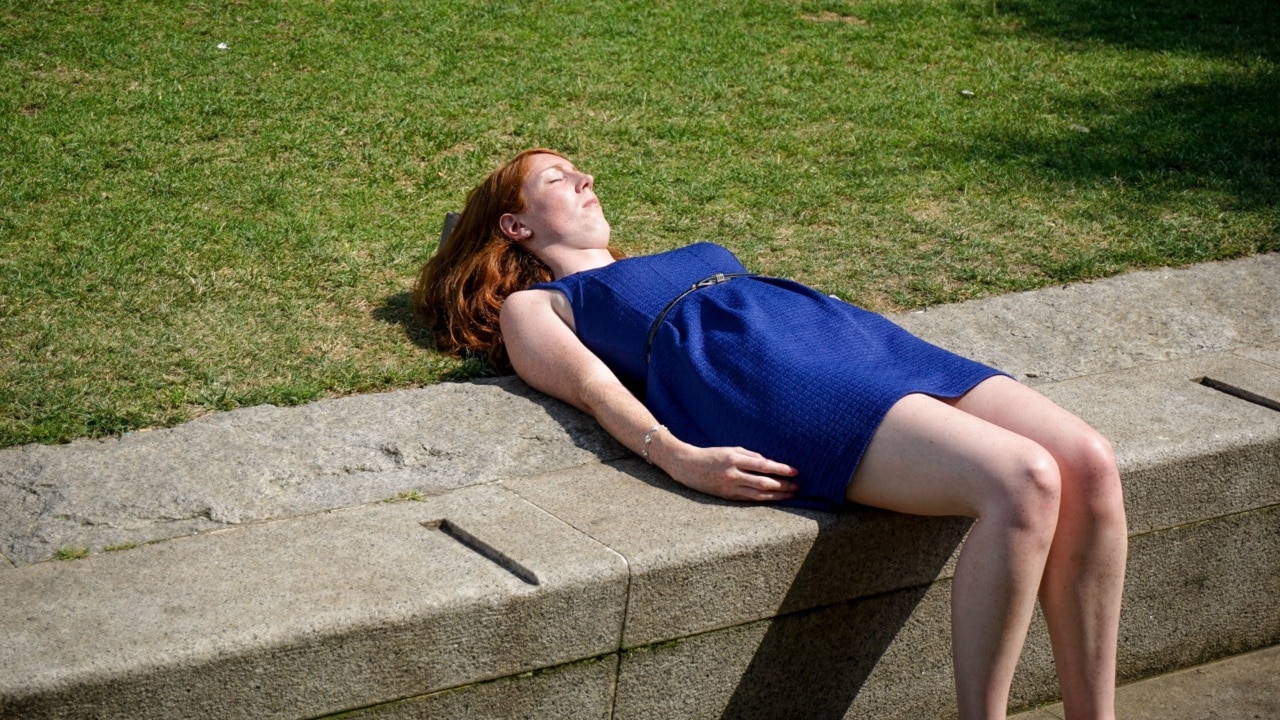
Summer ends with shocker heatwave and extreme fire danger across SA
The state is facing “one of the most challenging days since the 2019 and 2020 fire danger season”, the CFS has warned. But, according to Mali, there’s “little risk” of losing power.
SA News
Don't miss out on the headlines from SA News. Followed categories will be added to My News.
As the state gears up for the last day of the worst heatwave since 2019, people are being warned of extreme fire danger.
It is feared that a dry lightning storm expected later today will escalate the risk of spot fires popping up over the state.
Fire bans are currently in place for the Mount Lofty Ranges, Lower Eyre Peninsula, Eastern Eyre Peninsula, Finders, mid north, Yorke Peninsula, upper South East and the lower South East.
Ray Jackson, state duty commander at the Country Fire Service, told ABC Radio that Friday was going to be one of the most “challenging days since the 2019 and 2020 fire danger season”.
“We’re expecting really dry and hot conditions across the state and dry lightning, which has the potential to cause fire,” he said.

Mr Jackson said the CFS was prepared with regional centres monitoring weather overnight and into Friday.
“We’ve been preparing and communicating with our volunteers making sure they’re aware of what we can expect on days like today.”
Joe Szakacs, minister for police and emergency services, confirmed on Friday that a 737 water bomber, positioned at the RAAF Edinburgh base, is on standby.
“That will be available today to support our firefighters should they need,” he said.
Vince Rowlands, senior meteorologist at the Bureau of Meteorology, said any lightning that hits on Friday morning through to the early afternoon would be dry, before the cool change hits.
“There’s more of a concern in the morning and early afternoon,” he said.
“Be aware that any lightning that we do see today has the potential to be dry and start fires.”
Premier Peter Malinauskas told ABC Radio on Friday morning that there was little risk of people losing power today.
“There are currently no lack of reserve notices that AEMO have issued which is the sort of thing that would occur well in advance of a potential power loss,” he said.
“The state’s got the capacity to be able to produce enough energy to meet our needs.”
The premier said the only threat was if there was a “catastrophic event” that affects “transmission lines or substantial power generation”.
The Bureau of Metrology said the worst of the current heatwave should ease by the weekend.
Mr Szakacs reported on Friday that over 100 people – in metropolitan Adelaide – had been assisted by outreach services since the code red was declared on Wednesday.
In regional areas 50 people received assistance, with airconditioning relief centres being made available to them.
“This has been a very busy time for emergency workers,” Mr Szakacs said.
“I am proud of their efforts – and thank everyone who has worked tirelessly this week to help others.”
Professor Nicola Spurrier, chief public health officer, said there were less than 10 heat related presentations at South Australian hospitals on Thursday through to Friday morning.
“I think that’s because of the wonderful work (of) our whole community,” she said.
Friday was forecast to reach 40C with a chance of a thunderstorm late in the afternoon and evening.
Mr Rowlands said the cool change had already pushed through Ceduna and was expected to hit Adelaide around 5pm.
This weekend, Adelaide is forecast for a high of 24C on Saturday with a 30 per cent chance of a shower in the morning and the chance of a thunderstorm in the morning and early afternoon.
Sunday is set to reach 25C with cloud clearing and a minimum temperature of 14C.
On Wednesday, the first day of Autumn, Adelaide is expected to reach a maximum temperature of 26C and minimum of 13C. It is set to be cloudy.
Port Augusta will see a high of 42C on Friday with a drop to 29C on Wednesday while Mount Gambier is forecast for a maximum temperature of 39C on Friday and 20C on Wednesday.
On the cooler side, Ceduna is forecast for a maximum temperature of 29C on Friday with a slight drop on Wednesday to 26C.
An extreme fire warning is currently in place across most of the state.

Emergency services meteorologist Jonathan Fischer told ABC Radio the fire risk will reduce in the coming days.
“Beyond Friday, we’re going to see milder conditions develop over the weekend and suppressed fire danger,” he said.
“That’s actually going to continue right through much of the next week.”


Big crowds to gather for Adelaide, KI Anzac Day Dawn Services
A Kangaroo Island resident and decorated Vietnam War veteran humbly shares his story this Anzac Day. Find out where you can join a Dawn Service today.

Elderly driver hospitalised after train smash
The elderly driver of a car that collided with a train on a busy road in Adelaide’s inner southwest has been taken to hospital.