
Power outages across SA as wild weather hits state amid warning of early fire danger season
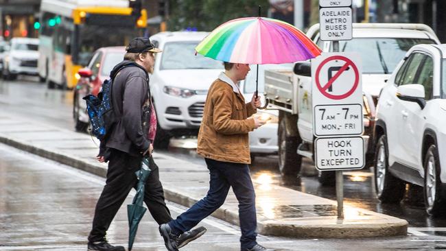
Thousands of people had to endure an uncomfortable night without power after steady rain, thunder and wind gusts lashed large parts of the state – with more storms expected today.

SA News
Don't miss out on the headlines from SA News. Followed categories will be added to My News.
Thousands of customers are without power across South Australia after wild winds, lightning and driving rain hit overnight.
It followed an uncomfortably warm night where the temperature in Adelaide didn’t drop below 19C.
By lunchtime, the number of reported outages across the state had risen to 28, however the number of affected customers had almost halved from about 3000 to 1780.
Among those affected at the peak of the outage on Tuesday morning were 1021 customers in the Angle Park, Ferryden Park, Mansfield Park, Woodville Gardens and Woodville North areas.
Supplies were also cut to 1497 customers across the Prospect, Kilburn, Enfield, Dry Creek, Angle Park, Ferryden Park, Mansfield Park, Woodville Gardens and Woodville North, and Broadview.
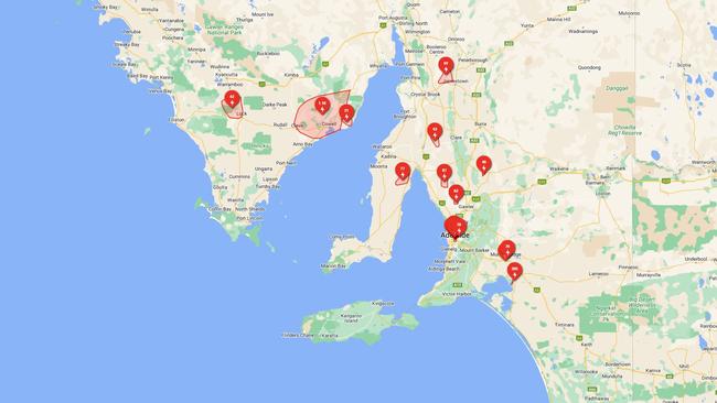
Across the state, 63 were left without power in the Fischer, Redbanks, Reeves Plains and Woolsheds area, 87 around Pinery, 40 near Buchanan, Hamilton, Hampden and Tarnma, and 43 around Snowtown, Blyth, Bowillia, Condowie and Everard Central, and another 69 at Jamestown, Tarcowie, Appila, Caltowie and Caltowie North and West, and Hornsdale.
Outages were reported along the Eyre Peninsula including more than 1130 in Campoona, Cleve, Cowell, Lucky Bay, Mangalo, Middleback Range, Midgee, Miltalie, Minbrie, Mitchellville and Port Gibbon.
The outage impacting Mitchellville, Erith, Grace Plains, Hoskin Corner, Owen and Pinery was caused by lightning, and SA Power advised restoration works were suspended due to safety concerns for crews.
The network advised on its website works would resume when “it is safe to do so”.
Extreme weather conditions also impacted supplies in Rudall with 18 left in the dark, and 63 without supplies in the Lock, Palkagee and Ulyerra area.
Extreme weather conditions also impacted 305 customers in Tailem Bend and Wellington East, alsong with more in the Murray Bridge area.
Much needed rain has also been recorded across parts of the state, with Mount Crawford topping the count with 21mm overnight and was also lashed with 74km/h wind gusts just after 7am Tuesday.
Nurioopta received 13.8mm of rain, Pallamana in the Murraylands and Riverlands recorded 11mm, while Roseworthy in the Flinders and Mid North region received a quenching 15.2mm.
Cleve Airport on the Eyre Peninsula received 14.8mm, and was lashed by wind gusts up to 69km/h.
The Adelaide Hills received between 10 and 15mm while the plains had 2 to 3mm of the wet stuff.
Strong wind gusts also were reported in Outer Harbor, recording a top 67km/h just after 4.50am, while 61km/h was recorded at Adelaide Airport at 5.30am, and Warburto Point on the Yorke Peninsula was slammed with 72km/h gusts just after 1am Tuesday.
Tuesday is expected to reach 29C with more showers and possible thunderstorms in Adelaide. Wednesday should be 28C and mostly sunny, Thursday should reach 30C with some showers, then the temperature will drop to 20C for both Friday and Saturday, with more showers, before a gloriously sunny 25C on Sunday.
Fire risk sparks early warning
Despite this week’s damp conditions, fire danger season has been declared earlier for three regions as the state braces for the fallout of a dry and warm winter and spring.
The fire danger season has been declared earlier than usual for three districts while two-thirds of the state report dry conditions.
The Eastern Eyre, Flinders and North East and North West Pastoral districts dire danger seasons starts October 15, while the rating has also been brought forward for both the Lower and Upper South East districts to start on November 1.
Country Fire Service Community Risk and Resilience director Alison May said the outlook was based on the warmer and drier than average spring which depleted soil moisture.
“Even though when you’re driving around the Hills and in the south it might look green, but you pull out a plant and it’s pretty dusty,” she said.
“What that means for a fire danger season is we’re seeing vegetation cure more quickly.
“At the moment, for most of the state and particularly the northern two-thirds of the state, it’s already at 100 per cent cured.
“It is more visible for grasslands where you can see it is dry and brown but for the forested landscapes and mallee areas that might still look green, what we’re being told from our local counterparts is the understorey is quite dry, the soil is quite dry.”
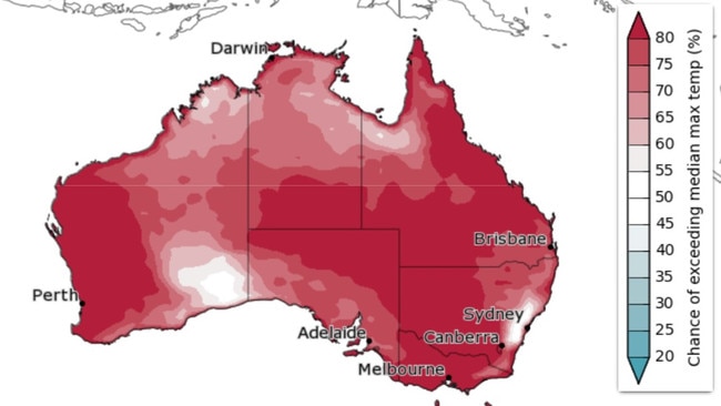
The Bureau of Meteorology is warning there is an 80 per cent chance of above-average maximum temperatures across Australia.
Ms May said South Australia’s year-to-date temperatures had been “well above average” with some parts “in the extreme above average”.
“And in terms of moisture, for vast areas of the state, it is well below average,” she said.


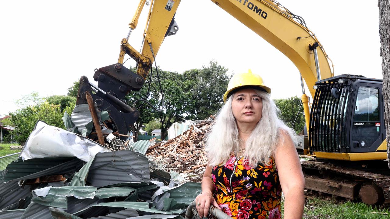
Meth-olition: House of hard work reduced to contaminated wreck
A landlord’s worst nightmare has come true after tenants left her house in a toxic and unlivable wreckage.

‘I thought it was a pimple on my neck’: Young woman’s devastating diagnosis
This young woman was given a devastating diagnosis earlier this year but she’s pushing through to ensure she can accomplish her magical dream.