
West Lakes lashed by 40-80mm of heavy rainfall as thunderstorm crosses Adelaide
More than 200 people called the SES for help as flooding hit parts of Adelaide. Meanwhile, an SA strike team will fly to NSW to assist with their weather event.
SA News
Don't miss out on the headlines from SA News. Followed categories will be added to My News.
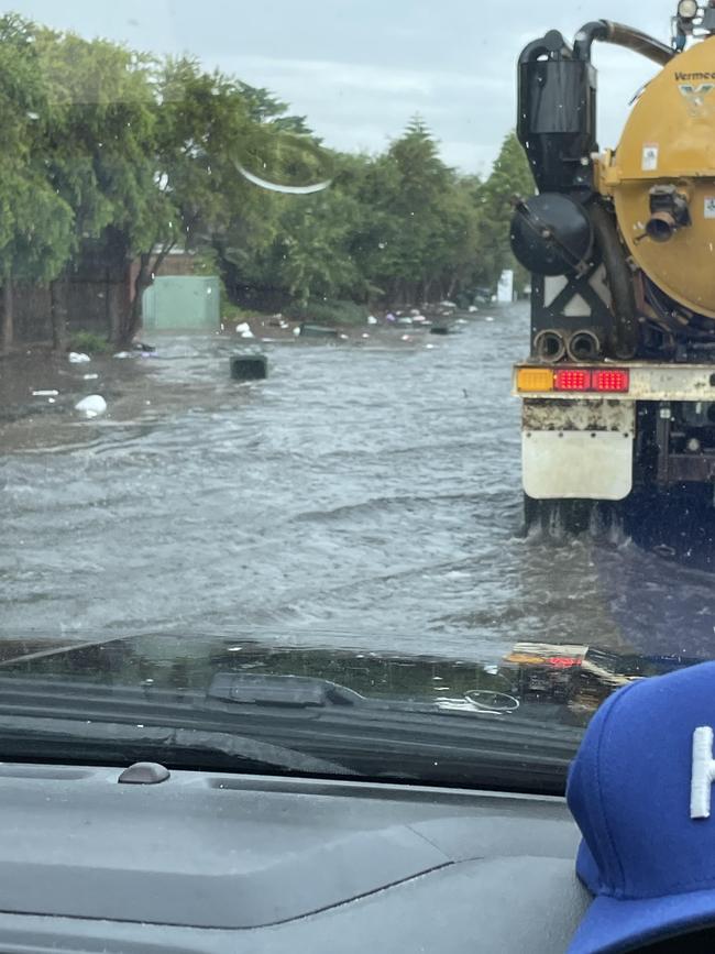
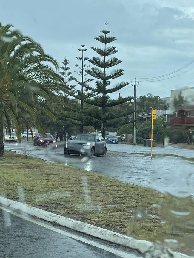
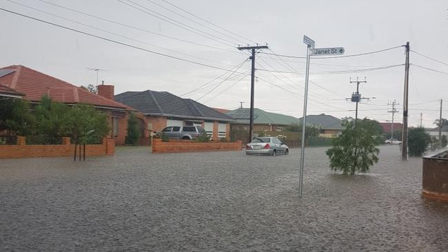
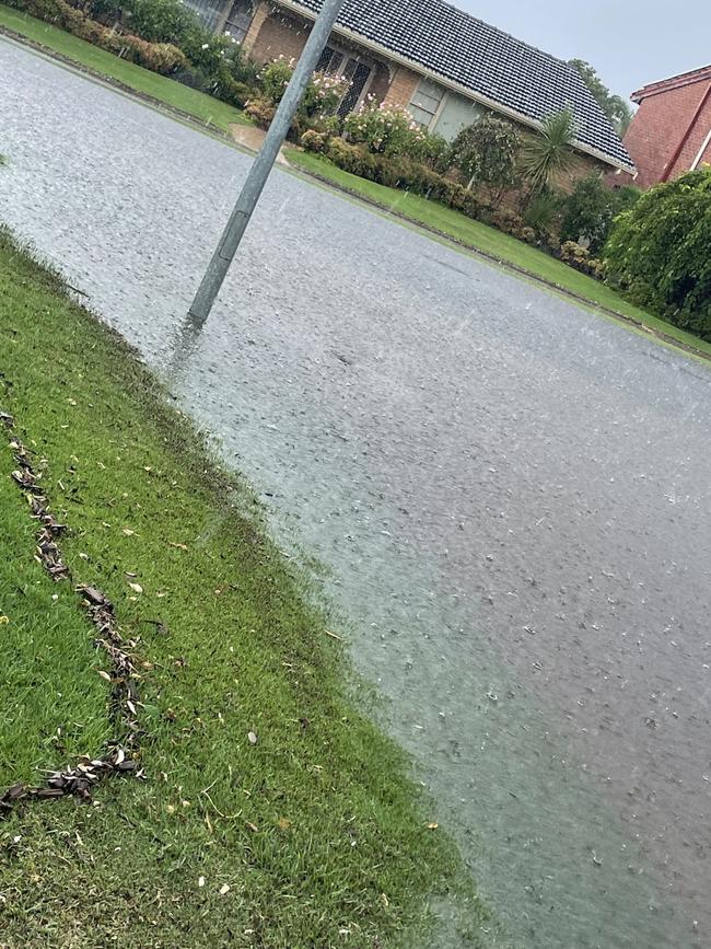
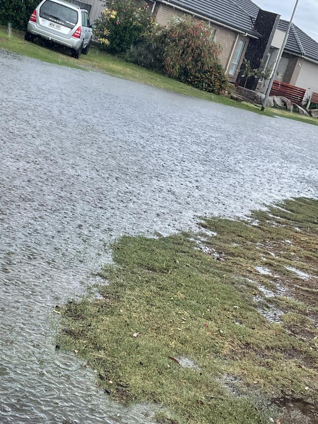
State Emergency Service crews were run off their feet responding to hundreds of call for help after a storm thrashed parts of Adelaide’s western suburbs.
State duty officer Brenton Clarke said SES crews responded to 235 calls for assistance on Monday until midnight, most around 2pm – of which 160 of them were in the western suburbs.
“Most of it was around the Seaton and Grange area which was the hardest hit,” Mr Clarke said on Tuesday morning.
“A lot of it was around sand bagging … and waiting for water to subside while moving water out of people’s homes.”
It comes as a team of SA emergency services personnel are set to fly to New South Wales on Tuesday morning in response to the dangerous weather situation north of their state.
The crews will depart from Adelaide Airport just after 9am.
Chief officer for the SA SES, Chris Beattie, said his thoughts go out to people interstate experiencing the devastating impact flooding can have on communities.
“South Australia has a long history of providing assistance to other states in times of need,” Mr Beattie said.
“The rescue technicians will play an important role in supporting the NSW SES during this severe weather event.”
West Lakes and surrounding suburbs were hit with about 40mm of rain in one hour on Monday afternoon.
A heavy downpour of rain led to Military Rd and the carpark of the West Lakes Shopping Centre being flooded about 3pm, while Tapleys Hill Rd between Ballater Rd and Grange Rd at Seaton was closed due to dangerous water levels, but has since reopened.
Bureau of Meteorology senior forecaster Jenny Horvat said it was “difficult” to explain why a specific area of Adelaide was lashed, but a convergence and sudden change of wind direction, combined with a humid air mass and sea breeze “enhanced” the downpour.
The highest rainfall totals were observed in Crafers West, where 21mm fell, South Para Reservoir, which saw 19mm, and Tea Tree Gully, which copped 17mm.
Parts of the Barossa were also lashed with an afternoon thunderstorm, bringing heavy rain, including 24mm near Lyndoch, and 28mm at Gomersal.
SA was hit with a total 14,000 lightning strikes on Monday.
.@BOM_SA has issued a Severe Thunderstorm Warning âš ï¸ - Adelaide Region for DAMAGING WINDS 💨 and HEAVY RAINFALL ðŸŒ§ï¸ For parts of Adelaide.
— SASES (@SA_SES) February 28, 2022
Issued 4:52pm Monday 28 February 2022https://t.co/plvmLQkJLL
Secure or put away loose items around your property pic.twitter.com/MOCm7U0e3M
Senior forecaster from BOM, Tom Boeck, said rain could fall in Adelaide in the late morning on Tuesday and there was a chance of a thunderstorm.
“But we’re not expecting as much rainfall as yesterday,” Mr Boeck said.
Adelaide is forecast to hit 27C on Tuesday.

Man arrested over horrifying Tranmere pedestrian crash
Police have charged a 21-year-old man over the death of a woman who was struck by a car while crossing the road outside Firle Kmart.

‘Like a Grand Prix’: Motorbike explodes after horror crash
A horrifying crash has left a West Lakes man hospitalised and his motorbike engulfed in flames after it exploded on impact.