
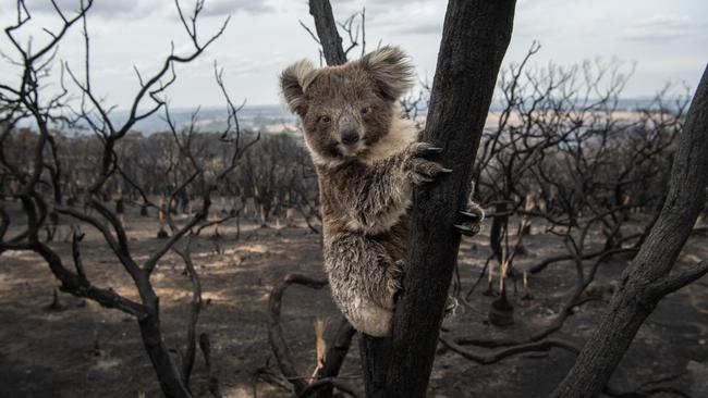
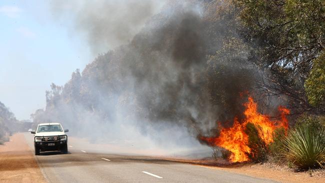
Satellite images reveal path of Kangaroo Island bush fire destruction
Satellite pictures have painted a harrowing impression of how much worse the KI bushfires of early 2020 were than previous disasters.
SA News
Don't miss out on the headlines from SA News. Followed categories will be added to My News.
The extent of Kangaroo Island’s horrific fires last summer has been revealed by satellite images showing it was twice as destructive as the next largest disaster, in 2007-8.
Detailed study of the 4405-square kilometre island shows 2100sq km was burnt out, pictured, compared with 950sq km in 2007-8.
Since the beginning of official records on KI in 1929, the four worst fire seasons by area burned were: 1954, 17.4 per cent of the island burned; 1959, 16.4 per cent; 2008, 19.5 per cent and 2020, 45.9 per cent.
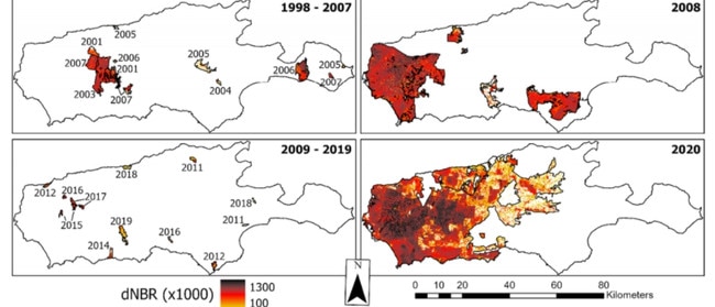
Lead author of the University of Toronto study Mitchell Bonney said the study showed clear evidence that fire severity was linked to infrequent burning in the years prior.
“The two largest fires, occurring in 2008 and 2020, both followed a roughly decade-long period of relatively little burning,’’ he said.
“This is especially true for the 2020 fires, where only 65sq km 2 or 1.5 per cent of the island burnt between 2009 and 2019.”
Mr Bonney said the study into how vegetation recovered was published this month in the journal Remote Sensing.
The issue has been prominent since Victoria’s 2009 Black Saturday, after which authorities had been criticised for not burning off enough.
“Another devastating fire season a decade later has undoubtedly revived the debate over best practices in terms of land management policies and reducing fire risk,’’ he said.
More Coverage

Join the conversation

Man arrested over alleged daylight suburban assault
A man has been arrested over an alleged assault that left another man seriously injured at South Plympton.
Read more

Deaf apprentice exploited in shocking unpaid ordeal
The owner of a former Pooraka car repair business has been fined thousands and ordered to back-pay a handicapped apprentice.
Read more