
Satellite images reveal damage inflicted by Cherry Gardens fire in the Adelaide Hills
Pictures taken by satellite show the full impact of the Cherry Gardens fire – as it continues to smoulder.

SA News
Don't miss out on the headlines from SA News. Followed categories will be added to My News.
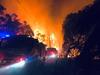
The full extent of the damage inflicted by the Cherry Gardens bushfire has been captured by a passing satellite.
Images from the Sentinel 2B last Saturday show the Scott Creek Conservation Park and Mt Bold Reservoir Reserve as fully intact.
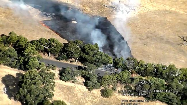
The next images from the PlaneScope satellite five days later show the area blackened, with more than 2570ha of native vegetation, grasslands and farmland burnt.
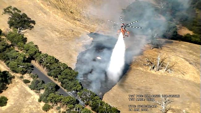
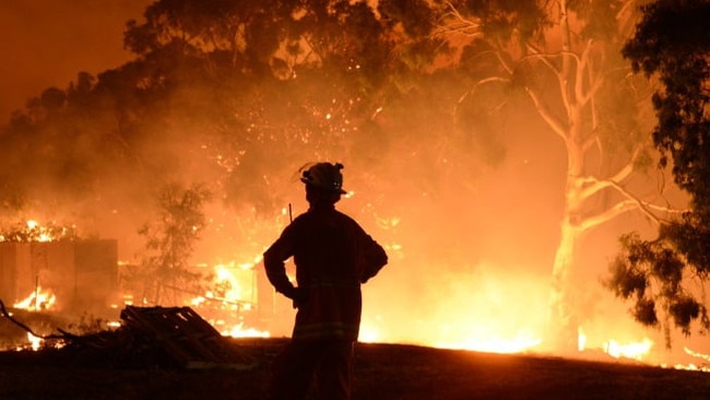
Hundreds of firefighters were dispatched to the area last Sunday when several fires, believed to have been lit deliberately, combined to create one huge conflagration.
The fire destroyed two homes and multiple outbuildings before it was contained on Monday night following heavy rainfall.
The muddy conditions made it too treacherous for firefighters to remain in the fireground, with most being pulled out.
Skeleton crews were left to monitor hot spots and flare-ups before reinforcements were sent back in on Tuesday.
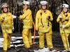
The CFS volunteers, supported by Department of Environment and Water and Forestry SA staff, have spent most of the week extinguishing hot spots.
Numerous calls have been made by residents near the fireground concerned about flames from trees during the night.
The CFS said on Friday this was typical behaviour as large logs continued to smoulder and catch alight.
“We thank the community for reporting these as this assists us in locating areas where there is a need for a concentration of resources,” it said.
“It is expected that this may be seen for quite a few days yet as we work towards making the area safe.”
The CFS said thermal imagery was being used to identify hot spots not visible to the naked eye.
“This morning we saw a patch of scrub well within the fireground in an unburnt island flare up with flames being seen by crews on the ground,” it said.
The CFS appealed for the public to stay away from the fireground to enable access by emergency services crews and other personnel such as SA Water and council workers.
It warned the area would remain unsafe until the fire was extinguished.
“Our firegrounds continue to be very dangerous places at this stage of the incident,” it said.
“Trees have a tendency to fall or drop limbs with little warning, patches of the ground may still be holding a lot of heat with a risk of burn injuries.”
The CFS said traffic restrictions remained in place around the 42km perimeter of the fire.
“Much of the community living within the fire affected area have now returned home and we ask those living and working within this area and surrounding areas to remain vigilant,” it said.
The CFS said reports of smoke or unattended fires should be made to triple-0 while anyone finding injured animals should contact SAVEM on 0477 055 233.

Fostering a place to create
South Australia’s first 10-year cultural policy, A Place to Create, will help ensure the state’s booming arts sector will continue to evolve, grow and thrive.

Leafy green nightmare: Hidden homeless reality no one expects
There’s an emerging ‘invisible’ face of homelessness for Adelaide women with jobs. Their stories are sobering.