SA weather: Adelaide set to reach October rainfall average after flash flooding in Mid North
Adelaide is expected to reach its October rainfall average today – just eight days into the month – as rain continues to drench the state. SA’s Mid North was hit by flash flooding yesterday after up to 50mm fell across the region.
SA News
Don't miss out on the headlines from SA News. Followed categories will be added to My News.
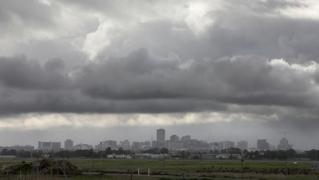
Heavy rain and severe weather in South Australia’s Mid North region yesterday has filled roads with water – with Adelaide expected to meet its October rainfall average rainfall today.
The wintry weather also downed several trees across Adelaide, including a large one at Spriggs Rd, Piccadilly, that brought down powerlines.
Locals say they’ve had six months’ worth of rain in just a few days and tourists travelling through the Flinders Ranges are being urged to take care.
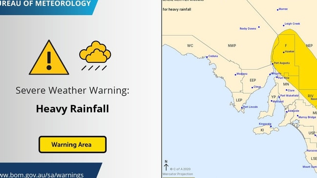
Showers developing in #Adelaide this morning. SA rainfall to 6:30 am Woomera 33 mm, Pt Augusta 23 mm, Snowtown 8 mm. A Severe Weather Warning for Heavy Rainfall which may lead to flash flooding in the Mid North, Riverland, Flinders and North East Pastoral https://t.co/cNCFXL5x6w pic.twitter.com/XwNwpc4oYc
— Bureau of Meteorology, South Australia (@BOM_SA) October 6, 2020
Flash flooding has been reported, with up to 50mm of rain falling across the area.
Closer to Adelaide, 10 to 15mm fell in the metropolitan area, with 15 to 20 in the Adelaide Hills.
Over the 24 hours until 9am Wednesday, Pt Lincoln recorded 36mm, 33mm fell at Woomera, Jamestown near Port Pirie had 27mm, while Mt Lofty had 29mm.
Adelaide has already recorded 43.6mm of rain so far this month, and the Bureau of Meteorology's senior forecaster Tom Boeck said we will hit the 44mm October average this morning.
“We’re probably going to go over that today with some showers coming in this morning,” Mr Boeck said.
The showers will ease this morning, but continue in the South East.
“The low responsible for that (the rain) is now south iof Mt Gambier, and showers in the South East.”
Conditions are clearing for a dry and sunny weekend.
“Gradually conditions will be easing for most of the state into Friday.”
Friday is forecast to reach 22C, Saturday is set for 23C and Sunday 27C.
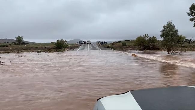
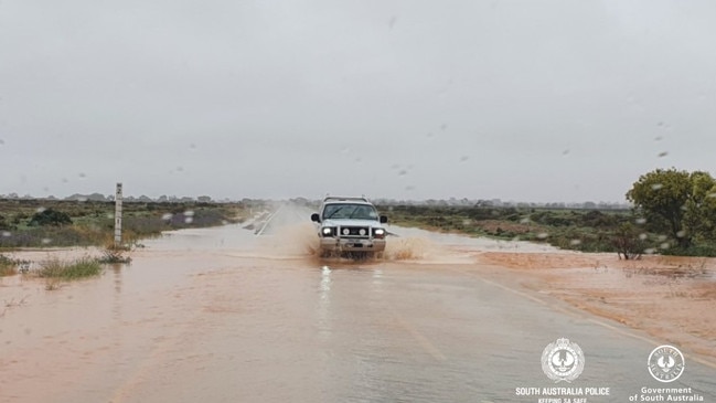
Flash flooding hits Mid North
Caravan and Camping Industries CEO Stuart Livingstone captured a video of him driving through large areas of water on The Outback Highway between Hawker and Parachilna on Wednesday afternoon.
“People had walked (across) before we drove across and it was quite safe, it was only about 40cm deep I think,” he said.
“It was quite safe to just take your time and there were plenty of people on the other side if you got into trouble.
“It was great because the area needed some rain.”
Mr Livingstone was staying at the Wilpena Pound Resort with his family when the rain fell.
“There’s plenty of people sitting around the fire keeping warm, it has been very busy,” he said.
“The area is really green, there’s water in the creeks, it’s a great time of year to go bushwalking and exploring the area.”
Forecaster Dr Paul Bierman said a low pressure system intensified across the southern parts of the pastoral districts and the Flinders Ranges on Wednesday afternoon.
“There is the potential of even heavier falls with the risk of 30-50mm in some isolated locations, if these heavier falls do occur, this poses a risk of flash flooding,” Dr Bierman said.
“And this hazard may affect anyone in the area, including tourists travelling through.”
The pressure system was expected to move into western Victoria overnight on Wednesday, while rain persists in SA’s South East and the southern agricultural area.
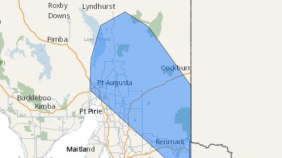
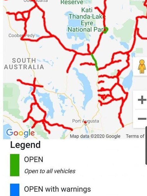
Multiple roads in the state’s Far North and South East were closed due to rain on Wednesday, including the Oodnadatta Track, Painted Desert Road, the Iron Knob to Hiltaba Track, the Hideaway to Curnamona Track and the Birdsville Track, among others. The roads will be reopened on Friday, if weather permits.