
Map shows extent of water in Murray Darling Basin as 50-year surge looms
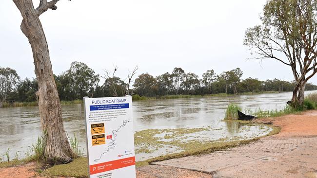
A new map shows the alarming amount of water already in the Murray Darling Basin – as the Riverland rushes to repair levees that won’t hold back the flood.

SA News
Don't miss out on the headlines from SA News. Followed categories will be added to My News.
A new map released by Mapping Services Australia shows the extent of water currently in the Murray Darling Basin and shows why the river on the South Australian side is predicted to record peaks not seen in almost 50 years.
As the rush to repair Renmark’s dilapidated flood defences takes on new urgency, new estimates show Murray River flows into SA could reach as high as 160GL a day, approaching peaks not experienced in 50 years.
The Flow Tracker map also records how much water is being held in various dams and lakes across the basin, and shows “total water storage’’ for October is sitting at 101 per cent. That is up from 86 per cent this time last year and 41 per cent in 2019.
It shows reservoirs and dams across Queensland and NSW sitting at close to capacity, or in some cases exceeding them. The Burrendong Dam in NSW, which holds three times as much water as Sydney Harbour, is listed at 137 per cent capacity.
The Menindee Lakes, which can be used to help manage flows into the Murray, is recorded as being at 104 per cent capacity.
The flow tracker map also lists the enormous amounts of water that will eventually flow into the Murray from tributaries such as the Murrumbidgee, the Lachlan, the Darling and the Goulburn.
The Department of Environment and Water on Friday issued its latest flow report, which confirmed earlier reports that “the flow will continue to rise during November and reach approximately 120GL a day in early December’’.
However, the report also said “further increases are highly likely as a result of more rainfall over the Murray-Darling Basin in the coming weeks’’.
DEW said the 120GL forecast was based on water already in the system and did not include the extra 100mm predicted to fall in the southern portion of the Murray Darling basin over the next week.
It said there was a “medium probability’’ flows could reach 140GL per day and a “low probability’’ that it could rise to 160GL. This would be highest since 1974 when flows reached around 180GL.
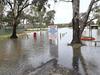
The state government this week sent engineers and flood planners to Renmark after The Advertiser reported that the town levees built to protect the town during the record 1956 flood had fallen into disrepair. It has promised to help the Renmark Paringa Council pay for the repairs.
The levees, which stretch more than 12km, are on a combination of state, council and private land
DEW manager of water delivery Chrissie Bloss said they had “been degraded because of erosion over time and not maintained’’. The Advertiser also observed some parts of the levee that had been removed through the use of heavy mechanical equipment.
Ms Bloss said the levees would start to come into use and protect homes and businesses when the rate of flow in the Murray reached around 130GL and would safeguard the town from far bigger flows if repaired.
“If the levees were in good structural conditions, there wouldn’t be overtops (water spilling over the levee) until over 200GL or more,’’ she said.
Renmark Paringa mayor Neil Martinson said council had started stockpiling clay to repair the banks.
“Work is already occurring now to ensure that we can get these levee banks to a suitable situation for when that 120 does eventually get down here,’’ he said.
Mr Martinson said with four weeks before the flood waters arrived in Renmark from interstate there was time to fix the levee, with the banks near the town’s hospital among the first to be repaired.
Local Riverland MP Tim Whetstone said there was still a lot of work to be done, including making sure residents had access to sandbags to help defend their properties.
Mr Whetstone said he was also concerned about arrangements for local residents when the Waikerie ferry was closed, which could happen as soon as next week.
“If they do close the ferry, it’s an extra 130ks a day for the school bus, you have ambulances, there are three police officers live at Taylorville who have to come over to Waikerie, so that creates a level of complexity there,’’ he said.

Join the conversation

Teen Parliament 2025: SA’s leaders of tomorrow set to inspire
Meet 30 young South Australians with big ambitions who will converge on Parliament House for the sitting of the 2025 Teen Parliament on Friday.
Read more

Freaky fitness: SA PT star’s booty call out has Adelaide split
A former SA fitness stars’ polarising comments on glute workouts being ‘too sexualised’ have been met with split views. Find out what Adelaidians had to say on the cheeky subject.
Read more