EPA groundwater contamination notifications now available in map form
For the first time, the EPA has provided a searchable map of contaminated groundwater across Adelaide.

SA News
Don't miss out on the headlines from SA News. Followed categories will be added to My News.
Locating records of contaminated groundwater in South Australia has never been easier.
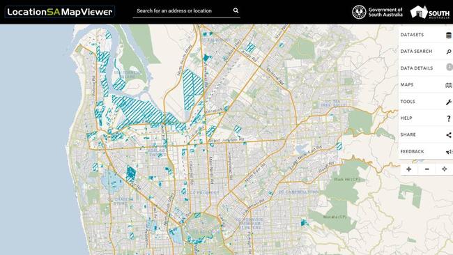
From today the Environment Protection Authority is providing online groundwater contamination records including prohibition areas and site assessments in a searchable map.
EPA chief executive Tony Circelli says this initiative is designed to improve public accessibility of information.
“The information the spatial maps portray is already available on the Public Register section of the EPA website, however the release of the maps acknowledges that many people may find the visual information more helpful,” Mr Circelli said.
“It’s important that anyone viewing these maps realises that they do not necessarily portray South Australian sites which are contaminated; what they show is records held by the EPA which date back to 1 July, 2009.”
The release is part of the authority’s commitment to being more open and transparent, and providing more timely information of environmental incidents to communities and the public, following criticism of the authority’s handling of Clovelly Park site contamination in 2012.
Since making that commitment the EPA has revamped its website and released data on its Public Register regarding radiation licences. The latest initiative is a collaboration with Location SA.
“The maps can be used to view Groundwater Prohibition Area boundaries where the EPA has
prohibited or restricted the taking of groundwater if site contamination affects or threatens
groundwater and presents an actual or potential risk to human health,” Mr Circelli said.
“The maps can also be used to show notifications received by the EPA, under section 83A of the Environment Protection Act 1993, of site contamination that affects or threatens underground water which have been placed in the EPA Public Register.
“It’s important to realise that some of the information recorded is historic and some sites shown on the maps may have been remediated or the contamination has since been assessed and found not to pose a risk.”