
Cold front brings wind, rain and hail, knocking down a Zoo tree, and snow is expected on Friday
Thursday’s strong winds have knocked down an large old tree at the zoo, taking out part of a monkey habitat. But Friday is expected to be even wilder, with snow in the morning.
SA News
Don't miss out on the headlines from SA News. Followed categories will be added to My News.
Wild weather that whipped through the state on Thursday afternoon has brought down a 70-year-old tree in the Adelaide Zoo’s monkey exhibit.
The Old English Elm tree fell around 12.30pm taking out part of the Golden Lion Tamarin tunnels.
Jeff Lugg, general manager of operations for Zoos SA said no animals or humans were reported injured and the area was quickly fenced off and cleared within four hours.
“Part of the Tamarin run also came down with the tree but no animals were harmed,” Mr Lugg said.

“We expect to get a modified tunnel open in time for the school holidays and fix it fully in a week or two.”
The roof of nearby toilets was also damaged in the incident.
“We take the safety of our visitors extremely seriously and were quick to cordon off the area and ensure nobody was in any danger.”

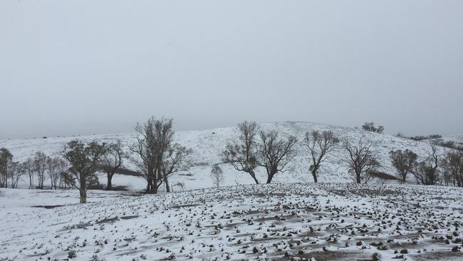
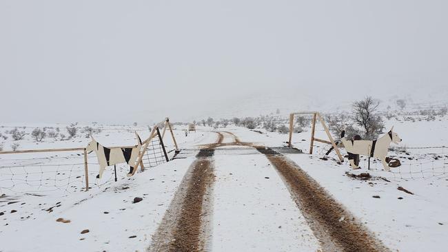
Snow is expected to fall on Mount Lofty and Flinders Ranges on Friday morning, as South Australia gears up for a polar plunge fuelled by a cold front on Thursday afternoon.
Duty forecaster at the Bureau of Meteorology, Jenny Horvat, said it was snowfall was possible on Mt Lofty and in the Flinders Ranges.
“We’ve got this low-pressure system developing in the southeast, it’s got an associated cold front,” Ms Horvat said.
“Some of those high peaks, the Mt Lofty Ranges and the Flinders Ranges, there’s a possibility for some snow flurries.”
A wintry blast is on the way for southern SA ⛄
— Bureau of Meteorology, South Australia (@BOM_SA) September 23, 2020
Image shows very cold air in the upper atmosphere moving over SA late this week - bringing showers, small hail and isolated thunderstorms across the south. Latest forecasts at: https://t.co/uom8D2pZpI pic.twitter.com/QB4y3SlAt7
The last time the state recorded snow in spring was in October 2012.
It may fall on Mt Lofty before sunrise, and in the Flinders Ranges up until 10am, the Bureau said.
Ms Horvat said a band of showers could bring thunderstorms and small hail across metropolitan Adelaide on Thursday afternoon, but the cold air will hit on Friday morning.
“We could see a thunderstorm here late (Thursday) and maybe some hail later,” she said.
Friday is forecast to reach a top of 13C, which Ms Horvat said was a colder-than-average day for this late in September.
Saturday is forecast to reach 15C, and Sunday a top of 18C.
SA should see temperatures back in the 20Cs early next week, with Monday expected to reach 21C.
It comes after snow fell in the Flinders Ranges at Skytrek Willow Springs Station last month.
Many regional centres recorded their lowest maximum August temperatures on record because of the snow.
A statewide code blue has been activated for Thursday night offering accommodation for people sleeping rough.