
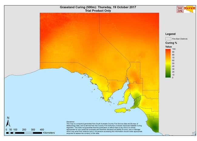
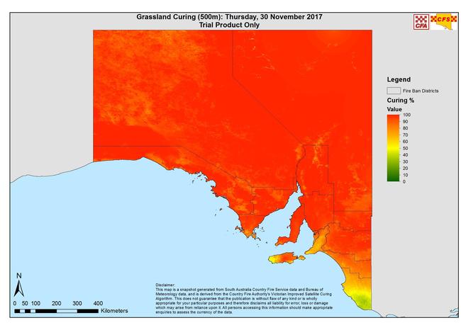
CFS satellite imagery shows dropping moisture levels in South Australia
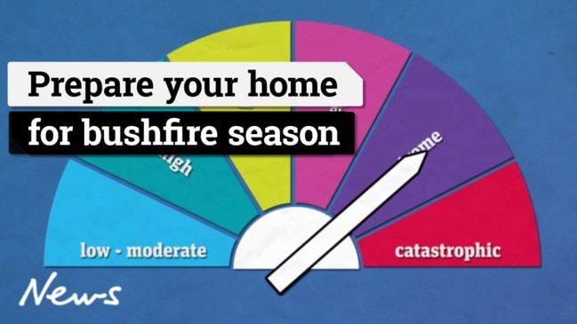
THESE are the maps that should make you shiver — and prepare your property for bushfire season as soon as you can.
SA News
Don't miss out on the headlines from SA News. Followed categories will be added to My News.
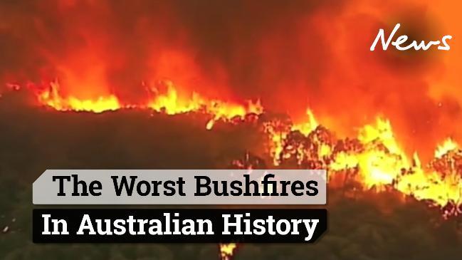
- Hell on Earth: South Australia’s worst bushfires
- How to prepare your property for bushfire season
- How to stay safe in a bushfire emergency
- Firefighting in the digital age
NEW satellite evidence shows much of SA is now at peak fire danger, prompting warnings from authorities to complacent property owners.
As the state braces to swelter on Tuesday and Wednesday, the imagery shows grasslands across almost the entire state are close to fully cured, setting up dangerous bushfire conditions.
Total fire bans have been declared for the West Coast and Eastern Eyre Peninsula districts on Tuesday, where the fire danger rating is listed as severe.
Temperatures are forecast to reach 36C in Adelaide and soar into the 40Cs in the state’s north and west.
The mercury will climb higher again on Wednesday, backed by stronger winds that could prove problematic for fire crews in the event a blaze starts. Widespread total fire bans are expected.
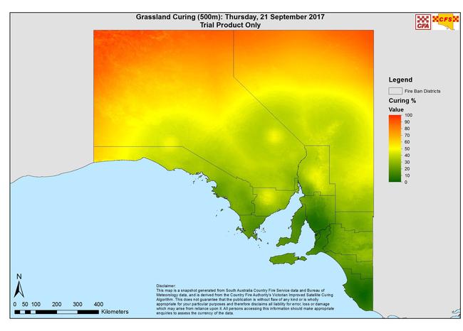
The satellite imagery is part of a trial across SA and the eastern states which combines on-the-ground observation of “fuel loads” — the amount of dead or dying grass — and satellite imagery.
The conditions are now at the most flammable point in the season and will remain that way for months. The satellite monitors the progress of enormous swathes of grassland, much of which is in the north of the state and cannot be monitored by sparse CFS crews.
The images capture the transition of the state’s grasslands from lush in winter to dry and dead in summer. Council fire prevention officers across the state still take readings of fuel loads in their districts.
This is then plugged into an ever-improving algorithm to create images which allow the CFS to monitor the progression of dry grass.
assistant chief officer Rob Sandford said the technology was still being refined and it was indicative of the future of firefighting and prevention.
“We are excited about the technology,” Mr Sandford said.
“It will allow us to better serve the community. The continuous research will help us better inform the community in the case of fires.”
The maps will be used to give the CFS ideas of where resources need to be distributed.
The release of the images coincides with concerning results from a study by the University of Adelaide and University of South Australia, which shows residents are reluctant to clear potential fuel from their property because they do not want to lose biodiversity.
Of particular note were properties in the Mt Lofty Ranges and Lower Eyre Peninsula, who the researchers said were “not willing to sacrifice local biodiversity to mitigate the bushfire risk”.
Sturt CFS group officer Dale Thompson warned against complacency.
“People need to have their bushfire action plan ready and make sure they have practised it,” he said.
“Part of a bushfire plan is ensuring their yards are prepared but unfortunately complacency is starting to show. There hasn’t been a really bad fire in the Sturt area for a couple of years but hopefully people are seeing what is going on in other places, like California, and realise that we are heading into a potentially dangerous summer.”
Ways to prepare for bushfire season
REMOVE dead branches, leaves and undergrowth.
PRUNE tree limbs that are lower than two metres above the ground or overhanging your home.
REDUCE, remove and manage vegetation such as long grass within 20m of your home and within 5m of any sheds.

Battle to save animals on the brink at Outback reserve
Conservationists are battling to save animals at an Outback reserve from the effects of the worst drought in recent memory, and have received a funding boost to redouble their efforts.
Country tradie to face court over incomplete work
A country tradesman will face the Elizabeth Magistrates Court over allegations he was not licenced and refused to refund money to clients.