
Adelaide weather: Hail and more rain coming
Authorities are warning of more rain and potential hail set to thrash Adelaide from today. Here’s what you need to know.
SA News
Don't miss out on the headlines from SA News. Followed categories will be added to My News.
More rain and potential hail is set to thrash Adelaide from Thursday.
Bureau of Meteorology senior forecaster Mark Anolak says chances of small hail were likely to be paired with showers from this evening.
“It’s just a cold air mass coming over, so there might be the odd small bit of hail in some of the showers tonight, it’s nothing out of the ordinary,” Mr Anolak said.
Adelaide will cop up to 8mm of rain on Thursday and a further 4mm on Friday.
“There will be periods of shower activity over the next few days, we stay in this unstable south-westerly airstream through tomorrow and into Saturday but gradually easing as we move through the weekend,” he said.
Sunday will be clear skies ahead of another wet start to next week with up to 10mm set to fall Monday.
“I think Sunday looks like the pick of the day for the weekend, but it could be wet again early next week,” Mr Anolak said.
“There is another system coming through for next Monday with some shower activity redeveloping.” Senior forecaster Tom Boeck said.
It comes as two climate drivers have caused the most late-winter rainfall in Adelaide in the past three years in just the first two weeks of the month.
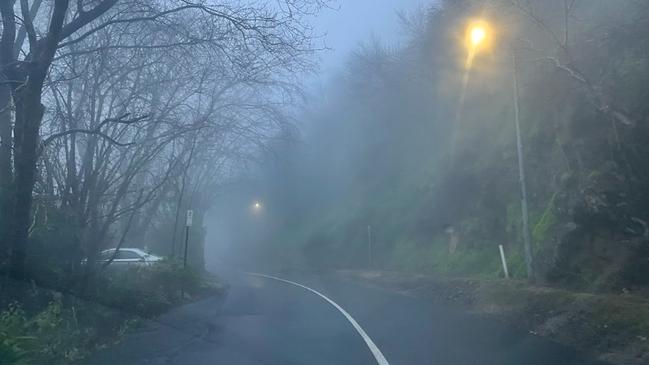
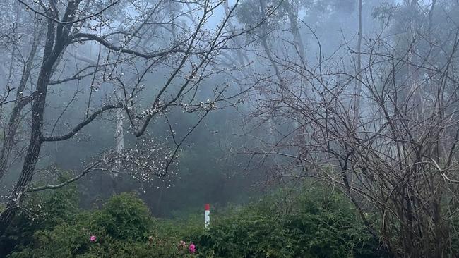
A road weather alert was issued in the Adelaide Hills on Monday morning as fog and rain lingered in the area.
The Bureau of Meteorology issued the warning early Monday about reduced visibility that could cause dangerous conditions on the road.
Duty forecaster from the Bureau of Meteorology Hannah Marsh said there has been five days below 15C for August in 2022, which is not unusually cold conditions for the time of the year.
“If we go back to 2020 we’d had six (days below 15C) by this point,” Ms Marsh said.
“It’s not uncommon to have quite a few days below 15C by the middle of the month.”
The average rainfall for Adelaide is 61.3mm, and by early this week 49.4mm had fallen, which is more than the entire month’s worth in the previous three years.
“We’ve got a few fronts that we’re expecting to come through over the forecast period so we’ll have to see what happens with those but compared to the past three years, the rainfall was all less than what we’ve had so far by the end of the month,” she said.
“So it is looking like a wetter August than we’ve had in the past three years.”
The La Nina weather event which brings more moisture across the season, and the negative Indian dipole which creates more cloud bands from northern and western Australia are also contributing to the moisture.
Grain Producers SA CEO Brad Perry said crops on the Eyre Peninsula were looking “as good as I’ve seen them” with prospects across the Mallee also looking bright.
“The mood from grain producers is generally quite positive and quite optimistic … while it has been dry in parts over the past couple of months, there’s been some strong rainfall in August and some good sub-soil moisture,” he said.
However, he said the rainfall had been patchy with some regions faring better than others.
BOM figures show 73mm of rain has fallen in Victor Harbor in mid-August, which compares to a total of 47mm for the entire month in 2021.
“At this stage, the state is looking good for a really strong harvest,” Mr Perry said.
.


Child protection laws scrutinised after heinous Vic childcare abuse
The SA Government is urgently exploring new measures to bolster child safety in the wake of the sickening child abuse allegations coming out of Victoria.
Read more

SA fishers reel as fee hike and algal bloom make double whammy
SA fishers grappling with the unprecedented algal bloom gripping our seas say the industry is being brought to its knees by rising licence fees, with no fish to catch.
Read more