Adelaide recorded temperatures below 1C, with patchy fog and frost in the north and hills
If you shivered more than usual this morning it’s because parts of the state dipped below freezing. Patchy fog and frost are forecast for Adelaide’s north and the hills – and temperatures won’t be warming up for the rest of the week.
SA News
Don't miss out on the headlines from SA News. Followed categories will be added to My News.
- How heavy fog shrouded SA last week
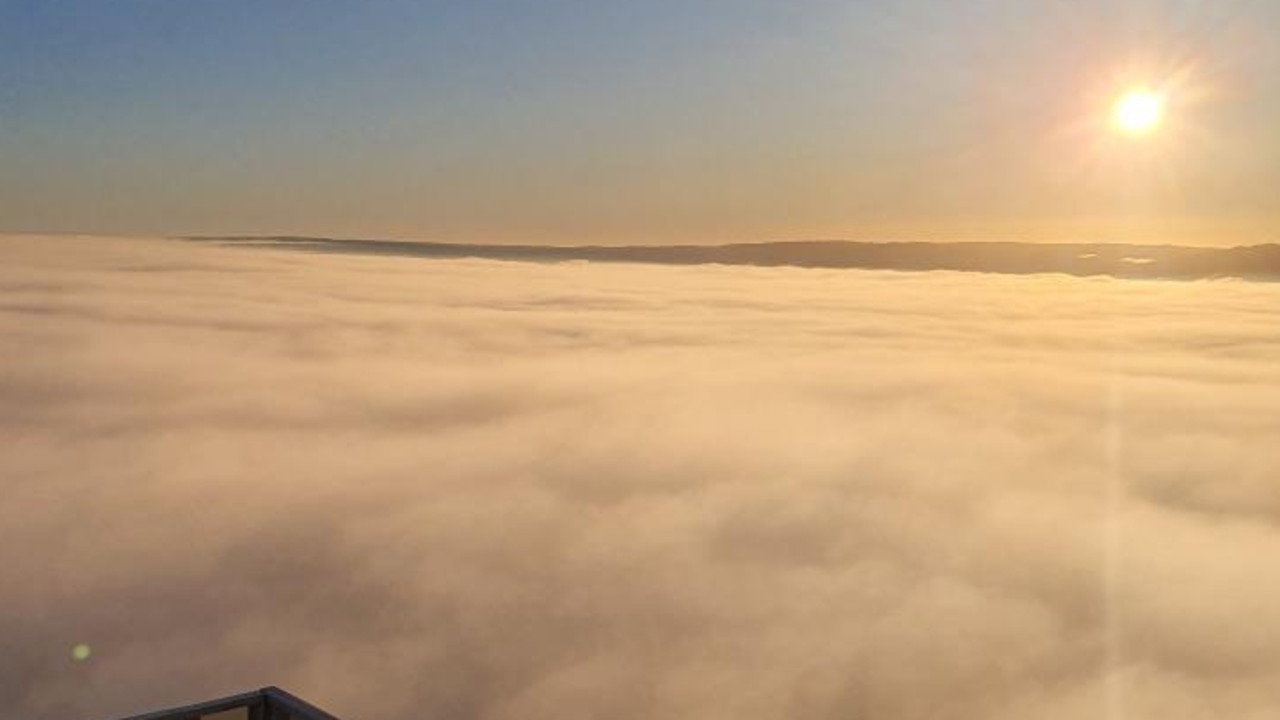
- Gallery: Extraordinary views above last week’s fog
- How to get the most out of your Advertiser subscription
It has been a cold and frosty morning in Adelaide today, as parts of the state have dipped below freezing.
Parafield Gardens Airport was the coldest recorded temperature in the state, dropping to -1.1C at around 6am today.
Other parts of the northern suburbs were below freezing, including Roseworthy, which reached -0.7C, and Nuriootpa, which dropped to -0.5C.
Senior forecaster from the Bureau of Meteorology, Jon Fischer, said the northern suburbs will see patchy fog and frost this morning.
“We do have some cloud pushing up from the south … if that cloud does come in it could be a cold day for these areas, with that cloud blocking the sun,” Mr Fischer said.
He said a couple of dozen locations recorded temperatures below 5C this morning, including Mount Lofty which recorded 3.1C around 6.30am.
Mr Fischer said a large high pressure system caused the frosty conditions.
“It was a cooler than average month due to large high pressure systems, and the drier than average conditions.”
Light showers are expected in the hills and southern suburbs today.
Adelaide will see below average temperatures for this time of the year today, reaching a maximum of 14C. The rest of the week will remain cool for Adelaide, with Wednesday forecast to hit 14C, and the warmest day predicted for Saturday, which will reach a high of 16C.