
How much rain Far North Qld is expecting as a new low may form in the Coral Sea
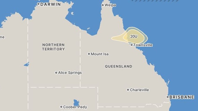
A tropical low may form in the western Coral Sea this week, bringing unsettled weather to northern Queensland.


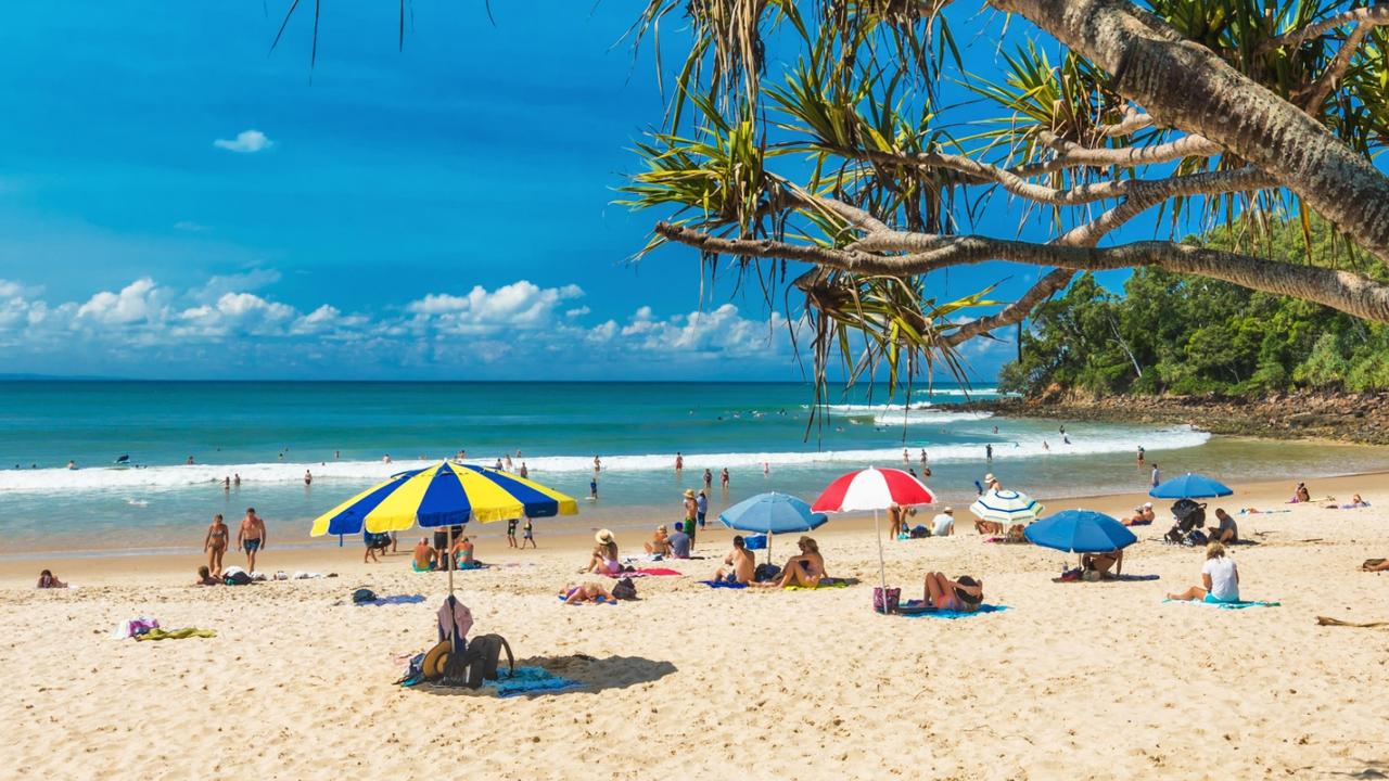
Cairns
Don't miss out on the headlines from Cairns. Followed categories will be added to My News.
A tropical low may form in the western Coral Sea this week, bringing unsettled weather to northern Queensland.
The Bureau of Meteorology said there was a low chance the tropical low 20U could develop into a cyclone as it moves southeast away from the Queensland coast.
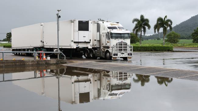
On Monday night, February 10, heavy rains returned to the northeast of Queensland.
Senior meteorologist Angus Hines said rainfalls became heavy across the northeast cost on Monday night.
“Widespread rain falls are forecast to continue through this region before decreasing on Wednesday,” he said.
In the last 24 hour period, 120mm was recorded at Kowanyama, with more than 100mm of rain already recorded their in the last few days.
“Some noticeable rain totals overnight closer to Townsville were 188mm at Rollingstone, 155mm up the Upper Black River,” Mr Hines said.
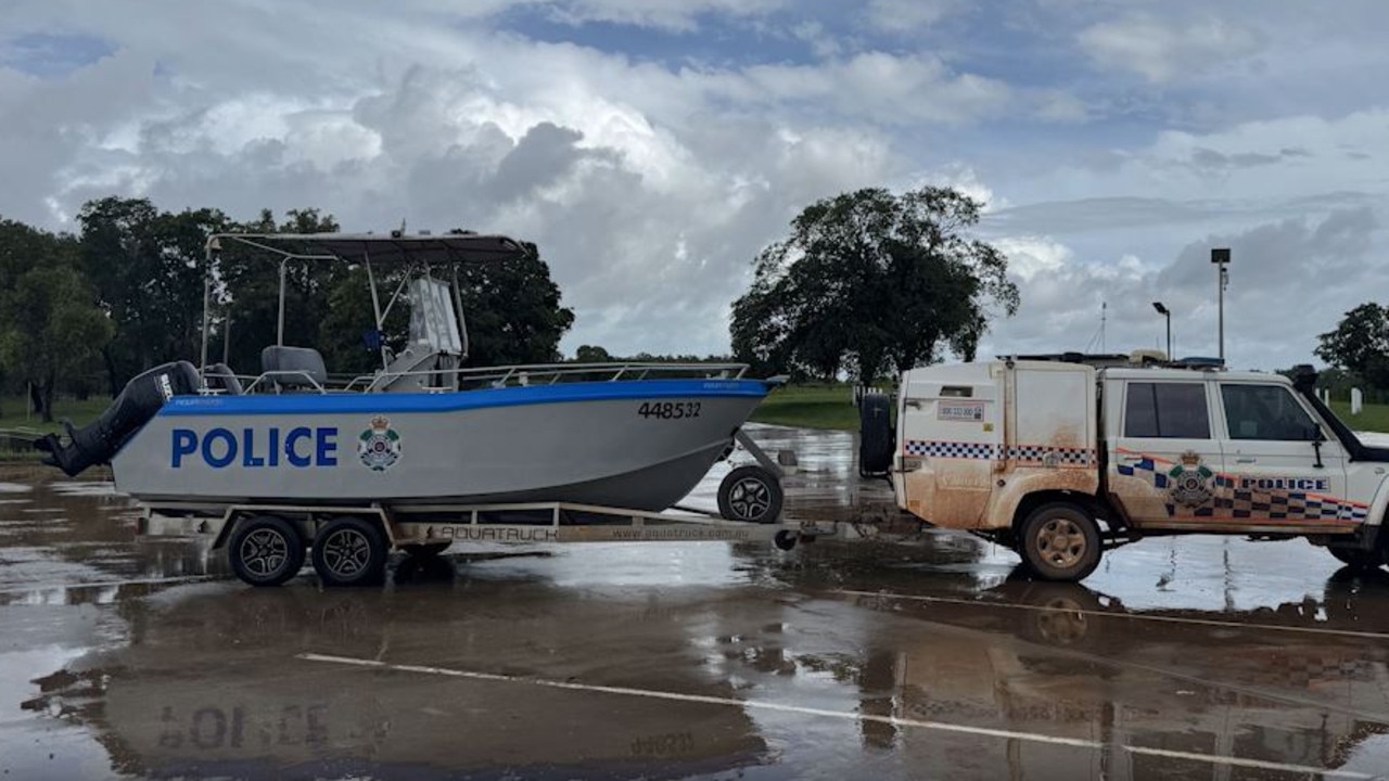
With an extensive flood watch covering parts of the western Cape York peninsula, Gulf country and much of Western Queensland, Mr Hines said this was due to widespread showers and storms.
Mr Hines said the focus was on heavy and potentially localised, intense flash flooding scattered across parts of Queensland.
“The southern Cape York Peninsula and the North Tropical Coast, are part of these warnings,” he said.
“These regions are covered by a severe weather warning.”
Mr Hines said there was the possibility some regions may see more than 100mm of rain in six hours.
Cairns ‘Stay Informed’ warning
Cairns residents were issued a ‘stay informed’ notice for the Cairns Region Council, at 12pm on Monday, February 10 warning a weak tropical low may form and gusts of 70-80kph could develop.
The Cairns Local Disaster Management Group (LDMG) also advised residents, the low could form near the North Tropical Coast.
A spokesman from the local disaster management group said gusts of between 70-80kph could develop overnight on Monday and into Tuesday.
“Severe thunderstorms also possible,” he said.
After recent rainfall totals had saturated the Cairns region, LDMG also warned more is on the way.
“Possible falls of rain of 30-60ml are forecast over the next few days,” the spokesman said.
“Mountain ranges and downward slopes may experience hazardous wind gusts causing possible tree damage.”
Road closures could also be impacted by tide movements, affecting parking in low lying areas near the coast.
After a “lucky lull” this weekend, Bureau of Meteorology meteorologist Livio Regano said Cairns residents experienced drier conditions but with a new weather system forming in The Gulf, more rain was expected for the region.
“The rain is going to happen all over again I’m afraid, but more down towards Townsville where they really don’t need it,” he said.
“Cairns is expected to receive up to 60mm of rain in the coming days as North Queensland braces for the impact of a new weather system in The Gulf.”
Mr Regano said areas around Cassowary Coast saw the heaviest rainfalls.
“Across the weekend between Saturday and Sunday about 100 to 150mm was recorded,” he said.
With about another 60 to 70mm recorded in the last 24 hour period since Sunday evening to Monday morning.
“Cairns is expected to see between 30 and 60mm of rain today (Monday) and tomorrow (Tuesday),” Mr Regano said.
Meanwhile, Townsville is expected to get more than 100mm in the same period.
“The weather is expected to ease by Wednesday, though there’s still some uncertainty with the monsoon, so it’s best to stay alert for any changes,” Mr Regano said.
Brief bursts of heavier rainfall and thunder are also expected early this week.
“Temperatures will be near average, with highs ranging from 29°C today to 31°C on Wednesday,” Mr Regano said.
Low temperatures will stay between 24–25°C, making for humid nights.
As for storms, there will be some embedded thunderstorms within the rain, Mr Regano said.
“This will especially impact on the Tablelands and along the coast,” he said.
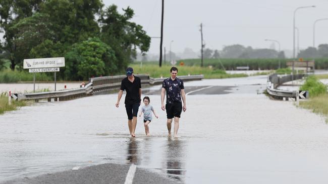
Most Far North Queensland rivers are either in minor flood or unaffected, with the Herbert River in Ingham being the exception.
The Tully and Murray Rivers are also under minor flood warnings.
The Bureau issued a minor flood warning for the Tully and Murray Rivers on Sunday February 9, just before 12pm.
The renewed warning was reported to hit around the peak at Euramo on the Tully River, in the Cassowary Coast Region.
A Bureau of Meteorology spokeswoman said additional rainfall over the coming days could raise river levels.
“The situation will be monitored with updates provided as needed,” she said.
“Minor flooding is expected to be occurring at Murray Flats on the Murray River, where river levels are likely to be falling slowly.”
More Coverage


Originally published as How much rain Far North Qld is expecting as a new low may form in the Coral Sea
Join the conversation
Qld tourism haven officially a hotspot for shark catches
Queensland’s most sharky beach has been revealed in the wake of the Sunshine State’s latest shark attack. SEE THE MAP
Read more
Tragic development in search for missing fisherman
WARNING: Aboriginal and Torres Strait Islander viewers are warned that the following may contain images and voices of deceased persons. Authorities will investigate whether a 60-year-old fisherman was taken by a crocodile or suffered a medical episode as the search for a man missing in remote Far North Queensland tragically enters the “recovery phase”.
Read more