
A damaged Kuranda Range that runs at a snail’s pace, a Barron River bridge at the end of its lifespan, and a lack of long-term vision for a second Tablelands access route is stifling Far North growth and eroding investor confidence in a perfect storm of missed opportunity.
Tunnels cutting through the Lamb Range, reviving Quaid Rd, a freight train service and a new road through the Redlynch Valley have all been proposed as solutions to future proof Tablelands access.
However any solution has been made more difficult by an long overdue review of the Far North Queensland Regional Plan and a lack of commitment to add the Kuranda Range road to the National Land Transport Network.
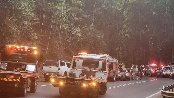
A recent 11-vehicle pileup on the Kuranda Range has catapulted a safe and reliable heavy vehicle hinterland access back into the spotlight.
Currently there are five routes over the Great Dividing Range from the coast between Innisfail and Mossman – the Rex and Kuranda Range roads, the Gillies Highway, the Palmerston Highway and the non-gazetted private Quaid Road at Wangetti.
However all are unsuitable in terms of efficient heavy vehicle access directly to and from sea and airports to the Tablelands.
A reluctance by the state to invest the billions of dollars required to totally rethink heavy vehicle access was evidenced by the alarming 2022 Cairns to Northern Tablelands Access Strategy, which stated the road would not need a major overhaul and “would not reach full capacity until 2051.”
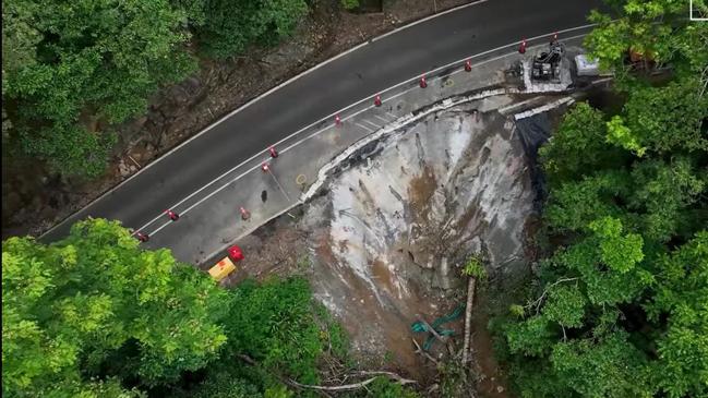
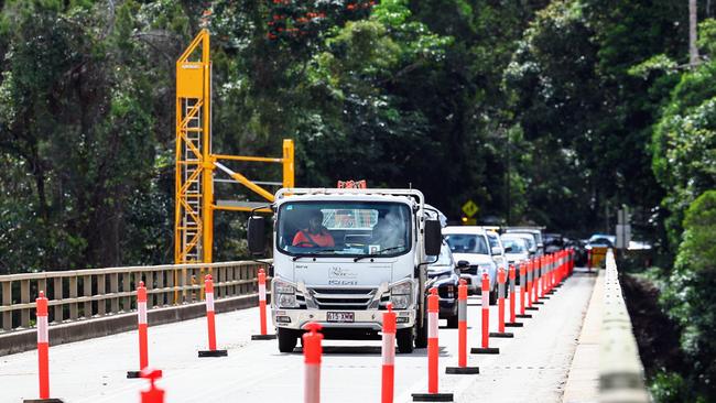
With the route blocked 44 times a year between 2015 and 2019 for an average duration of 6.6 hours, the deleterious state of the Barron River bridge, and long-running roadworks to repair damage from ex-Tropical Cyclone Jasper, pressure for a substitute route has never been greater.
A proposal widely accepted as the most feasible is the Reddicliffe Highway.
The route was first mapped out by Ron Reddicliffe for former Barron River MP Martin Tenni in the 1960s.
The proposed route is a 18-23.5km four lane highway from Davies Creek over the Lamb Range and into the Redlynch Valley where an elevated roadway will cross over the Redlynch Intake Road before joining the Cairns Western Arterial Road near the Lake Morris Rd turn off.
Other, more radical solutions, involve the boring tunnels through the mountains.
Championed by federal Kennedy MP Bob Katter the Bridle Track involves a 16km road and a 1-2km tunnel linking Davies Creek to the Bruce Highway near Mount Sheridan.

The road is expected to cost $1.5bn but there has been no significant spending to investigate whether the route stacks up.
Former underground miner Brett Duck has also pitched a radical Tablelands access route using a series of tunnels under World Heritage-listed rainforest between Smithfield and Black Mountain Rd.
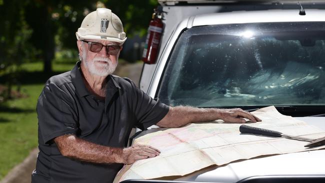
A German expatriate with a lifetime’s experience in road and railway projects, Wolfgang Rusch has advocated for an upgrading of the existing Kuranda Range rail track to enable a freight train service.
Advance Cairns chief executive Jacinta Reddan said the group had pushed since 2022 for $22m study aimed at finding the best alternative route over the range.
“But so far it seems to be falling on deaf ears,” she said.
“Access to Cairns and the Tablelands is at the forefront of our considerations, to unlock the potential of the region and growing export market, population of the region and liveability of Cairns.”
According to the Department of Main Roads and Transport Road Planning and Design Manual, tunnel grades should be limited to 3.5 per cent, meaning for every 100m of tunnel the elevation can’t rise more than 3.5m.
With Mareeba at an elevation of 500m above sea level, to meet the TMR design manual rules, an entirely tunnelled road would need to be more than 14km long.
A Tablelands access tunnel is not the preferred option of the Queensland Trucking Association according to spokeswoman Frances Schafer, who stated it was not an ideal solution for carrying dangerous goods or for Australian Defence Force movements.
“And there’s a good chance it would need to be a paid toll road as well to cover costs,” she said.
But International Tunnelling Association president Professor Arnold Dix believes a tunnel is a realistic solution given recent landslides that destroyed parts of the Kuranda Range Rd in December last year.
“The interruptions to the existing road network due to landslides etc, would all be eliminated with a tunnel option,” he said.
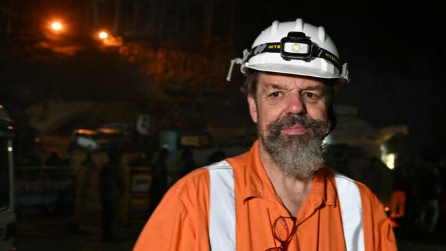
“This is the reason many developing countries put tunnels in, it is about secure and reliable transportation options.
“The world bank is funding projects exactly for this purpose in many developing countries.”
While there’s no shortage of ideas, progress on futureproofing access has been stifled by an antiquated Far North Queensland Regional Plan due for review in 2019 that has suffered delays on delays.
The latest delay of a long-term vision for the region has been blamed on the flood impacts of Cyclone Jasper.
According to the Department of Housing, Local Government, Planning and Public Works the regional plan “review is well underway.”
“A draft plan anticipated later this year and public consultation to follow,” a spokesman said.
Another roadblock to reliable and safe Tablelands access is the federal government’s dawdling over adding a section of the Kennedy Highway between Smithfield and Mareeba to the National Land Transport Network.
Turning the Kuranda Range Rd into a national highway is considered an essential step toward any significant upgrade of the notorious mountain pass which would unlock millions in federal funding.
With the Kuranda Range Rd reduced to single lane operation in two places and no full opening date given by TMR, and only one lane open across the Barron River, no plan to build a new road and a new bridge not expected before 2031 under a $450m Labor election promise, Leichhardt MP Warren Entsch said the situation was a perfect storm of missed opportunity.
“We’re squandering opportunities and sending them to Townsville,” he said.
“If they go down the Palmerston they are not going to do a left turn and come to the Cairns port.”

Mr Entsch said the only solution to the problem was to start looking at an alternative route now.
“It’s probably going to take a decade to build and we have to start somewhere rather than relying on a 60-year-old bridge that is well past its used-by date,” he said.
“Rather than kicking the can down the road and looking for fairies in the back garden we have to start looking at solutions.”
Transport and Main Roads Minister Bart Mellish in a statement to the Cairns Post said the state government in partnership with the federal counterparts has $262m on the table for Kuranda Range upgrades.
“Whilst recovery works are ongoing following Tropical Cyclone Jasper, the scope and timelines of that stream of works will be confirmed,” he said.
“It is my view that the Kennedy Highway be added to the National Land Transport Network.
“I note the LNP have made no commitment to add Kuranda Range Road to the NLTN.”
One solution to take pressure off the Kuranda Range road is an upgrade of the almost forgotten route connecting Wangetti to the Mulligan Highway.

Completed in 1989, Southedge-Wangetti Rd, known locally as Quaid Rd snakes through mountain rainforest of the Macalister Range beginning near Hartley’s Crocodile Adventures at Wangetti to emerge at Mulligan Highway near Lake Mitchell.
Controversy surrounds the private road which was granted planning approval, but never gazetted, due to an application made under World Heritage Properties Conservation Act following a change of government when Joh Bjelke-Petersen lost power in 1987.
Mr Entsch has called for the reopening of the road, which he claimed to be the only Tablelands access route that remained passable during the Cyclone Jasper disaster.
But Wet Tropics Management Authority executive director Scott Buchanan outlined why the WTMA was opposed to opening the route to the public.
“(The area) is an evolutionary hotspot and a ‘critical bottleneck’,” he said.
“Increasing land use pressures in this area would have severe impacts on the movement and population health of these species.
“Opening a new corridor to regular road traffic, particularly in the area in question, would have even more severe negative consequences on the forest and its flora and fauna.
“The cumulative effects of fragmenting the landscape would cause unacceptable impacts to the area’s World Heritage values.”
Public use of the route would likely increase traffic on the Captain Cook Highway and according to Wet Tropics, the road has been assessed by TMR and does not meet design standards.
“So opening it would be unsafe and would create risks for users,” Mr Buchanan said.
It’s understood the release of a more fluid Far North Regional plan able to be updated at regular intervals is going through final approvals now, but it’s not known if it will be released before the state election in October.
“It will be a living plan and updated more often, it won’t be cast in stone, which is good news,” Ms Reddan said.
“But a seven year time frame is way too long (for the Kuranda bridge) we’re urging that be accelerated and brought online much quicker.”
Add your comment to this story
To join the conversation, please log in. Don't have an account? Register
Join the conversation, you are commenting as Logout
Fingernail-sized frog faces pig-sized problem
A naturalist who discovered a fingernail-sized frog on a remote Queensland mountain is now racing to save the species from extinction three decades later.
‘Triggers me’: Urgent funding called to fix Far North’s hospital helipad hotspot
A Far North MP is calling on the state government to include funding for a new helipad at Cairns Hospital in the mid-year budget with Health Minister Tim Nicholls admitting that the current Esplanade landing spot “triggers” him.