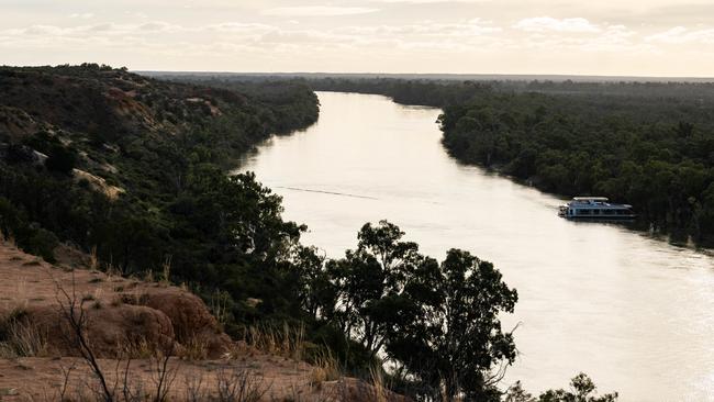
River Murray levels are at a five-month high, but no floods predicted
River Murray levels are at a five-month high, with boaties and recreational users on notice – and experts weighing in on speculation of further flooding.
Adelaide Hills & Murraylands
Don't miss out on the headlines from Adelaide Hills & Murraylands. Followed categories will be added to My News.
A “high flow advice’’ has been issued for the River Murray, with recreational water users urged to exercise caution – even as authorities say there is only a “small likelihood of extra inundation’’.
The Department of Environment and Water issued the advice Friday afternoon as river levels rose to their highest level since February, when the devastating floods of December and January were still receding.
DEW said the flow at the South Australian border was 38GL on Friday and was predicted to rise to 45GL over the next week.
The news comes as some in the Riverland and Mid-Murray, who are still recovering from the biggest floods in almost 70 years, are becoming nervous that a repeat was possible.

At its peak in late December, around 190GL a day was flowing down the River Murray, causing extensive damage in towns such as Blanchetown, Swan Reach and Morgan.
However, in its release, DEW made it clear it was not issuing a “flood warning’’.
“With water flows at these levels the areas expected to be impacted would be disconnected wetlands and depressions along the edge of the river,’’ a DEW spokesperson said.
The spokesperson also said that current river levels were similar to this time last year but the longer forecast is for warm and dry weather as opposed to cool and wet 12 months ago.
DEW said it was still safe to use the river for recreation.
“People are encouraged to enjoy the River Murray, while being aware of the hazards and acting responsibly to stay safe,’’ it said.
“Operating watercraft and swimming in the main River Murray channel can be more hazardous during high flow. Submerged objects, debris and the force of the current can present a risk to public safety.
“People operating watercraft, swimming, canoeing or participating in other activities on the main River Murray channel are advised to be aware of the risk of high flow, and take precautions to protect life and property.’’
The department said that the increased flows had been caused by increased releases from the Hume and Dartmouth dams in Victoria, as well as rainfall in tributaries in the Goulburn and Ovens catchments.
It also predicted the flow would be “relatively stable’’ at around 40GL a day until the end of August when it would start to decline. The department said while there had been above average rainfall in June across the southern portion of the Murray-Darling Basin, it was expected that would fall to lower than average between August and October.


